2WALKandCYCLE 2024 Presentation
Herenga ā Nuku Aotearoa presentation given to the 2WALKandCYCLE conference in Whanganui ā Tara on 18 March 2024
Off road access — a part of the solution
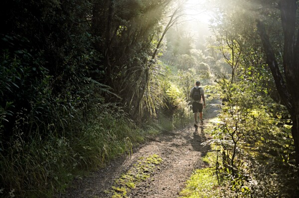
I want to talk to you today about what we think is a missing piece of the puzzle when people have conversations about scaling up walking and cycling. This conference has rightly spent and will continue to spend a lot of time talking about built roads— by which I mean not just the bits with cars and trucks on them but the bits off to the side where we put other forms of transport, like bikes, and jandals. It’s all formed road. The right of access over them is legal, enduring, public and practical.
Cambridge Terrace, Wellington (a formed road)
I want to make a distinction between pathways and access.
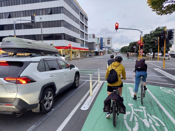
So that road outside—Cable St, and all its tar-sealed mates—is already legal public access. For most people who work in the field, your work focuses on how access is converted into pathways —what percentage is footpath vs. car, how bikes are separated from pedestrians, and so on.
Built roads define, divide, constrain, and manage public access. They also enable greenhouse emissions and pollution into waterways.
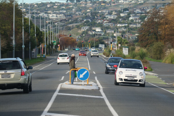
Photo by Ben Jassin, Christchurch City Council
For Herenga ā Nuku, our legislative role is about access. Pathways are somebody else’s job. Probably yours. Thanks.
Most transport planning is urban-focused, and for good reason—that’s where most people are, where most journeys happen, and where most access already exists.
But there is also a whole lot of public access that is not formed roads.
Types of legal public access
There are many different types of legal public access. These include:
Unformed Legal Roads
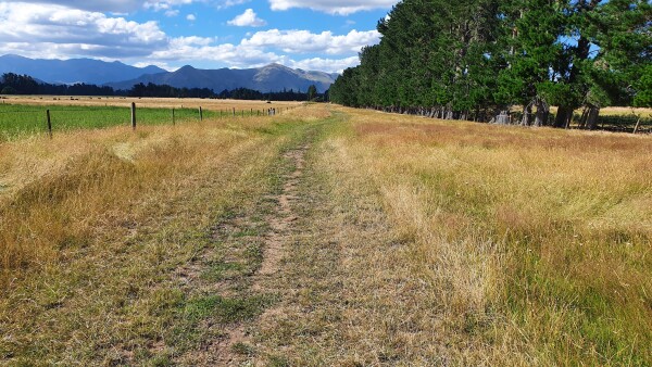
Photo of unformed legal road in Hurunui, by Mary-Anne Baxter
An unformed legal road provides the same rights of public access as a formed legal road. Unformed legal roads are recorded on survey plans but not always readily identifiable on the ground, which is why they are often referred to as ‘paper roads'.
To give you a sense of scale:
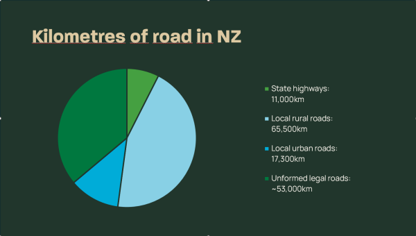
These can be viewed as long fingers of public land that can sequester carbon, connect communities, and provide safe, health-giving space for recreation.
Unformed legal roads have the same legal public access rights as formed roads. Access may not be practical – but it is legal.
Other unformed public access
That’s just unformed legal roads – other unformed public access spaces include:
- Marginal strips are created on riparian margins. Some of these move with the water and others are fixed in location, and like roads, they can be affected by erosion and accretion.
- Esplanade reserves protect coastal and riparian margins. They are fixed in location.
- Reserves, under the Reserves Act 1977, are preserved and managed for their conservation, public recreational, and educational values.
- Various types of easements, including walkway easements, rights of way, esplanade strips and access strips.
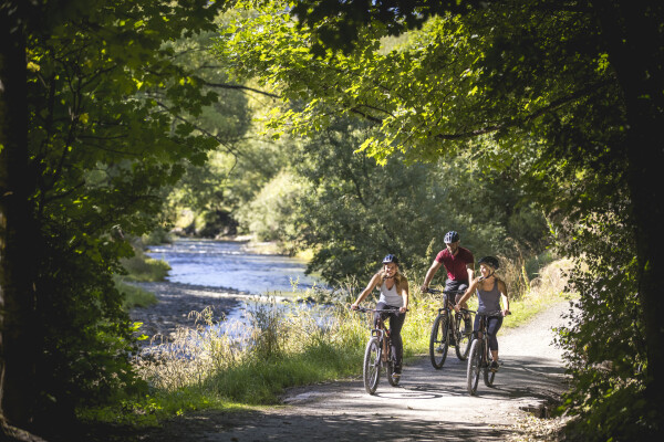
Photo by Destination Queenstown
When we use unformed public access, it is usually a mix of recreation and transport. And that is a good thing. A good bike trail can be both a recreation asset that promotes wellbeing and a transport asset that solves climate, health, productivity, and transport pressures. Many of the bike trails around Queenstown were built as recreation assets (with one eye to tourism), but surprise, surprise, they have become commuter pathways too. But off-road access and connectivity appear to fall into a grey zone—not funded through transport budgets and not funded through recreation budgets. Rather, local community groups fundraise and apply for grants for them.
Herenga ā Nuku tends to work in these places where public access is not so clear or well-established — usually, these are rural and peri-urban areas. Part of our job is supporting outdoor recreation. And part is supporting active transport.
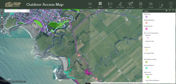
Kawatiri Coastal Trail
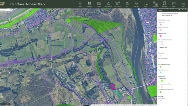
Unformed legal roads that sit under the Kawatiri Coastal Trail
An excellent example is the Kawatiri Coastal Trail between Westport and Charleston.
We have supported the Kawatiri Coastal Trail since it started planning its route in 2015. It is building a 55-km trail from Westport to Charleston, a family-friendly heritage cycle and walking trail. It will pass through gold rush heritage sites and areas of high significance to Ngāti Waewae.
We have provided grants for the survey and legal costs. We have helped the Trust use the walkway easement tool in our legislation, enabling it to manage the walkway as one unit rather than a string of separate sections.
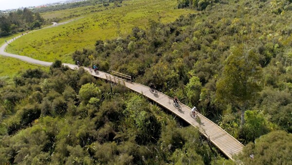
Photo by Kawatiri Coastal Trail Trust
The trail is primarily flat, with gentle climbs on a smooth track, making it a pleasure for walkers and cyclists of all ages and abilities. It will have several entrances and exit points, so walkers and bikers can do short sections, and communities along the trail can provide hospitality and tourism.
Charleston-Westport Coastal Trail Trust's feasibility study shows the trail will attract over 8,000 cyclists to the region and up to 80,000 walking journeys each year. It will help sustain 100 jobs and bring more than $5 million in visitor spending per year to the region. That is more jobs and income than the Holcim cement factory, which when it closed in Westport, people said would be an economic tragedy for the town.
Peri-urban regional strategies
Unformed public access is a mix of recreation and transport. And that is a good thing. A good bike trail can be both a recreation asset that promotes well-being and a transport asset that solves climate, health, productivity, and transport pressures.
That is why Herenga ā Nuku has invested energy in recent years in helping local communities develop off-road pathways in peri-urban areas -those rural areas on the edge of urban areas, before they develop into urban areas. These are based in Taranaki, Te Tairāwhiti, Mangawhai to Pūhoi, North Waikato and now Northland.
Regional projects are our way of taking the unconnected existing and potential unformed public access and turning it into a coherent network of public access. They are about giving the unformed public access to the same strategic planning structure we give the formed roading network. That's why they are important to this conference—because they are a way of giving unformed public access the same strategic value in terms of health, wellbeing, and transport that we give to the formed road network.
Pūhoi to Mangawhai
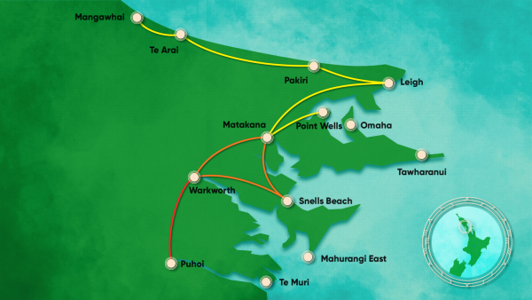
Puhoi to Mangawhai Project
The Pūhoi to Mangawhai Trail project, which we are supporting, creates a massive network of trails linking Northland to the big city.
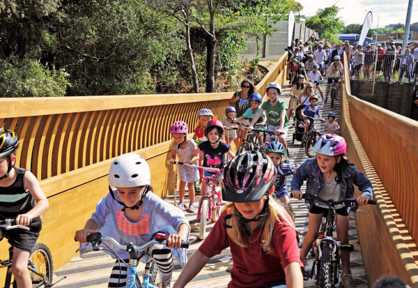
Photo by Matakana Coastal Trails Trust
We collaborated with Ngāti Manuhiri, Auckland Transport, Auckland Council and the Matakana Coast Trails Trust, which has a vision for a sustainable, shared-use commuting and recreational trail from Pūhoi to Mangawhai.
390,000 estimated uses per year. $78M Health Benefits (Improvement in Health Outcomes of domestic users). Creation of 330 jobs during the construction phase.
Tairāwhiti
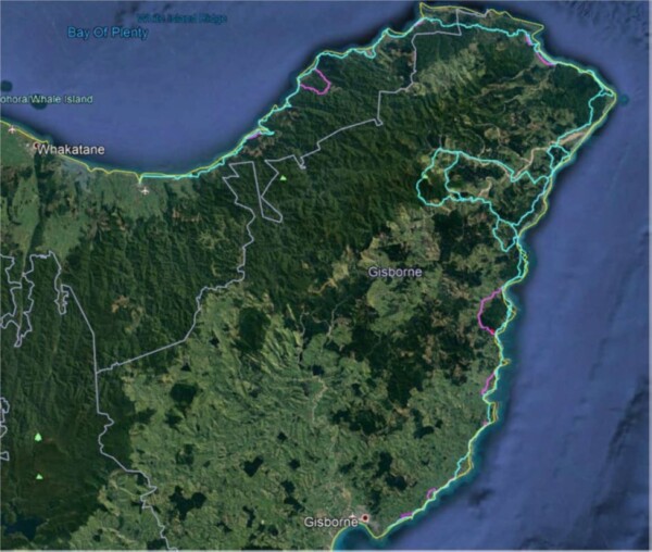
Tairāwhiti – with the blessings of Te Rūnanganui o Ngāti Porou, a Trust has been established to manage trail development for Te Ara Tipuna. The project vision is for a 650km trail - the kaupapa is cultural reconnection for the Ngāti Porou diaspora. Involves a mix of off-road and road-edge connections, unformed legal roads, ancestral trails, private land, ahuwhenua blocks, and tidal access. Key lengths of trail can be used for emergency access during extreme weather events that are becoming increasingly common in the area. Early planning has identified some separation for walkers, cyclists, and horses where needed.
Conclusion
A successful strategy to increase the number of walking and cycling journeys will need to develop off-road and on-road pathways.
Our transport network must change dramatically to favour low- and zero-emission transport. This change must extend beyond built roads. We need to develop off-road tracks and trails to create a network that crosses public land, private land, council land, and land over which local hapū and Māori organisations hold mana whenua.
The role of off-road public access in transport is vital because it changes how we travel. When kids can bike to school along a bush path rather than the road, they are happy, exploring nature and safe. But they also create more space on the roads for those who need it. Fewer parents driving their kids to school during peak hours means more space and smoother traffic for hard-working trucks, tradies and couriers. More office workers mountain biking along trails to and from work doesn’t just increase a town’s sales of lycra. It also increases that town’s happiness, healthiness and connectedness. And again, it frees up the roads for the types of traffic.
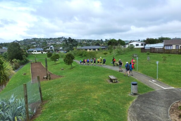
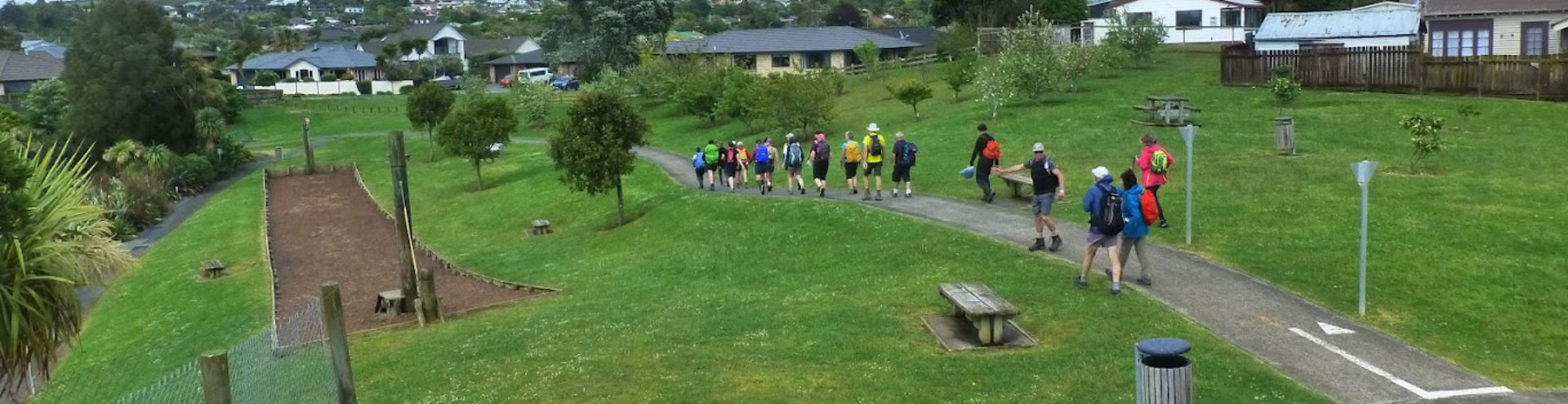
Pukekohe 5 Summits Trail
It’s tricky to retrofit these types of off-road paths into our towns. But it is also tricky and expensive to fit increasingly different modes of transport onto a single road—cars, buses, trucks, bikes, walkers, e-scooters...
If we allow people to combine their transport, outdoor recreation, and happiness in a single bush-clad off-road journey, we are making a better, more sustainable investment in all our people.
Nō reira
Tēnā koutou, tēnā koutou, tēnā tātou katoa