Photo by
Bernard Spragg NZ.
Te Araroa trail section: This is a fine high-country trail providing a challenging traverse through Te Kāhui Kaupeka Conservation Park. You'll walk from the south side of the Rangitata River through to Boundary Stream at Lake Tekapo.
The start of the track is signposted at the Bush Stream carpark beyond Mesopotamia Station, and is mostly unformed but marked with poles from there. Access is via Rangitata Gorge Road. The huts en-route are classic 8-bunk musterers’ huts and add an important historic dimension to this tramp.
If driving to the trailhead on Rangitata Gorge Road take care to follow the correct gravel track which forks to the right immediately after passing the Mesopotamia Station farm building and passes through the fence line over a cattle stop. The wider gravel track straight ahead is a privately maintained private road and is signposted No Access at the first fence. Please respect farm access restrictions. Te Araroa benefits from landowner's goodwill.
Follow markers from the carpark up towards Bush Stream. The path across the stony matagouri flats is not easy to follow as the marker posts are not always visible over the scrub. The trail crossed a farm road and skirts a small canal. After passing the canal the track crosses a low ridge behind a row of poplars. Walk to the left along this ridge a short distance and look out for a 4WD track heading up towards the gorge across the wide matagouri flats to the stream. This is much easier than trying to find your own path through the matagauri. At the stream travel is up, or adjacent to, the river bed, crossings as required. It is not necessary to zig-zag across the river bed to each orange marker pole. Choose your own route based on the river braids as you find them. These crossings are straightforward in normal flows but can be tricky after rain or during spring when the stream is fed by snow melt. Take extreme care at these times. Crossings are recommended as early as possible in the mornings during the snow melt.
The Sawtooth Bluff can be particularly tricky. Before reaching Sawtooth, approximately 5 km from the start, cross to the left (true right) bank as the stream at Sawtooth is narrow, steep and deep, even in moderate conditions.
The track later leaves the stream bed at a marked point on the left and climbs over a steep ridge to avoid a gorge section, and then descends back towards Bush Stream.
To ford Bush Stream a final time head up the true right bank another 50m from where the trail reaches the river bed, to a spot where the river forks and creates a small island in the middle of the fork. Cross directly below the fork and onto the island. From there you need to cross the rest of the stream on a North bearing. As you cross you will be moving with the river current, slightly back downstream. There is a rock wall on the true left. When crossing you can use the lower parts of the wall to aid in the crossing or just cross it and come out on the gravel bank on the true left bank of the river, just above the orange triangle marker. Follow the marker back onto the Bush Stream Track and up to Crooked Spur hut.
From the true left side a formed track climbs towards Crooked Spur Hut (5 bunks). This track was still used for mustering purposes up until 2009. The climb to the hut takes about 1hr.
Crooked Spur Hut is tired but provides adequate accommodation. It’s in a good location with views down Bush Stream to the Rangitata River.
From Crooked Spur Hut the track goes west around Crooked Spur and climbs steadily for 1.5hrs to a saddle at 1500m. From the saddle the track descends to cross Pack Horse and Sweeps Streams before returning to Bush Stream. Travel is then up the true left bank to an old stock bridge. Cross it to reach Stone Hut. Stone Hut (8 bunks) is in reasonable condition.
DOC have removed the bridge over Bush Stream marked on Te Araroa map 122 at km 2364.4, and on NZTopo50 map BX18. Local signage indicates the required stream crossing below the hut.
Beyond the hut Te Araroa follows Bush Stream to Royal Hut (8 bunks). Prince Charles and Princess Anne reputedly visited as children, hence the hut’s name.
The first part of the day involves a climb over the Two Thumb Range via Stag Saddle (1925m), the highest point on Te Araroa.
From the hut cross Bush Stream and follow the poles upwards. The climb to the saddle is fairly steep in places but quite safe in reasonable weather. The contours ease towards the saddle, where cell phone coverage is available.
From the saddle it is possible to scramble up to the ridge on the right hand side and then to descend the ridge line past the turn off to Rex Simpson Hut (private) and 1468m to a 4WD track. While unmarked this route is generally sound underfoot and affords excellent views across Lake Tekapo to Mt Cook. This should only be attempted by people confident in navigating and should not be attempted in poor weather. Turn left onto the 4WD track, which fords Camp Stream on its way to Camp Stream Hut (6-bunks).
The alternative marked (and poor weather) route down from Stag Saddle is lightly poled and runs down into the tussock covered Camp Stream Valley. Lower down this valley the 2 routes converge at the 4WD track, turn left here to access Camp Stream Hut, which is on the true left side of the stream. Camp Stream Hut is compact but in reasonable condition.
The track leaves Camp Stream Hut for the Ski Field Road. Trampers leave the hut and follow the track down the true left of Camp Stream, before crossing the Coal River just above the confluence and then continuing on the true left of the Coal River before the steep climb to the road. There is a car park well down the road for those wanting to exit here.
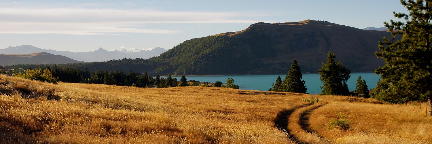
Meanwhile, Te Araroa continues on conservation land parallel with Lake Tekapo and along the base of the Two Thumb Range. The track crosses Washdyke Stream on its way to Boundary Stream where it descends above the true right bank to a car park at Lilybank Road.
Follow the road shoulder 13km south towards SH8.
The road walk ends at the Lake Tekapo Regional Park, which affords lakeside walking for the final 3km section into Lake Tekapo Village.
Northern Start: Bush Stream carpark, Rangitata Gorge Road
Southern End: Junction of Pioneer Drrive and SH8, Lake Tekapo Village
Methven Shuttle are a local service who can take hikers to and from the trailheads around the Rakaia and Rangitata Rivers. P: 027 405 2217, Text preferred as cell coverage is limited. E: bookings@methvenshuttle.com. See website for details
Many other accommodation options are also available.


Total 2 photos. Click image above to view them all.
Before starting Te Araroa either as a through-walker of the whole country or a section walker, please register on Te Araroa website. Please also visit the website or download the app for detailed maps, trail alerts and other relevant information.
We encourage you to continue gaining the skills and knowledge required for a safe trip. The NZ Mountain Safety Council has lots of free resources and information you can use. These can be accessed via www.mountainsafety.org.nz.
We recommend trying these online learning tools:
Additionally, check out the range of helpful videos available from the NZ Mountain Safety Council YouTube channel.
