Photo by
Tomas Sobek
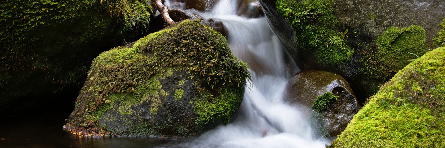
Te Araroa trail section: From the open tops high above the Telford Burn, Te Araroa through-trampers get their first glimpse toward the south coast.
From the highway, the route follows Princhester Road to DOC’s Lower Princhester Hut (6 bunks). Princhester Road is a gravelled public road, but also a working farm accessway. Please give way to stock and farm operations and leave gates as you find them.
No dogs are permitted.
The track from Lower Princhester Hut is through beech forest and climbs to a saddle between the Bog Burn and Waterloo Burn catchments. It then descends to the northern boundary of Waterloo Station, a Crown Pastoral Lease comprising 3,500ha. It is about 4.5km to this point.
Waterloo Station is private property but the lessees allow tramper access down their western boundary to Aparima Hut (12 bunks). The route is poled through tussock land on the bush fringe and marked through the bush-clad headlands. Care is required to stay on the permitted track line.
Note: The next section to Lower Wairaki Hut is predominantly within the forest. The ground trail is light, or non-existent, so care and concentration is required to travel from marker to marker.
Cross the Aparima River on the swingbridge near the hut. The track forks here. To the left, there is access out to Dunrobin Road (2 hours). Meanwhile, Te Araroa follows poles westward (to the right) through marshland on the terrace above the Aparima River’s true right bank. The track reaches the forest edge after 2.5km. Once within the forest, the marked track rolls over foothills to a sign-posted junction with the Wairaki River Track. Turn left here and it’s a 45-minute walk downstream to the Wairaki River ford. Cross the river here, as river levels allow, and climb to the nearby Lower Wairaki Hut (4 bunks).
The sign-posted track departs to the side of the hut and traverses the bush fringe. After about 600m the track crosses a stream, a marker then indicates a right-hand turn and the beginning of the climb towards the Telford Tops. Carry water from here as it’s the last reliable stream until the campsite.
The climb to the ridge is steady and steepens towards the end. Once on the ridge, the track turns left and follows the ridge. After 440m the track emerges on the tops, which afford good views south towards the coast. Marker poles continue down on the main ridge for another 2km. The track then leaves the ridge to the right and descends through grasslands to the Telford Campsite, which has a toilet and water available from the stream. Trampers should camp here if arriving after midday (see Mt Linton Station conditions of access below).
There is no shelter at Telford Campsite.
Note: This section is entirely over Mt Linton Station, which is privately owned, and is closed for lambing from 25 September to 7 November inclusive each year.
There is no vehicle access into Mt Linton Station, beyond the main station office.
In order to comply with the daylight hours condition, trampers should start no later than 10am while daylight saving time is in operation (earlier when it is not) and make steady progress towards their destination.
Much of the route is over a working farm, so trampers may encounter vehicles and the movement of stock in large numbers. In these situations, farm operations have right of way. Trampers need to step aside and wait quietly until all livestock have passed. Please take direction from farm staff as necessary.
There is no drinking water available en route, so trampers should carry sufficient water to last the day.
From the Telford Campsite the route follows poles down the true left side of Telford Burn to a sign-posted crossing. Ford the river here, as river levels allow, and continue on the farm track down the side of the Wairaki River to a marked sharp turn away from the river.
From here you follow well-marked farm track through the hills before dropping back down and sidling above the Wairaki River. The farm track descends onto a large fan down to river level – follow the marked route to the optimum crossing point. In general, the river runs barely above ankle height and will be easily crossed. Do not attempt to cross if it is high, dirty or fast-flowing.
Coming up from the river you will again join a farm track - this is one of the Station's main accessways, so keep a close eye out for stock or farm traffic. Following that track 2.75km and not far around a 90-degree bend, a well-marked turn will take you off the major farm track onto a lesser one. Continue on that track through paddocks, around forestry plantation and take in the sights and smells of New Zealand's largest farm station.
On occasion, the route will leave farm tracks, but it is well marked – just look for the capped posts and/or stiles across each fence. Follow Te Araroa map 152 carefully at km 2866.3 as the green route has been corrected from that shown on previous maps and still marked in black on the NZTopo base map
Towards the end of the route, cross Orauea Stream on the footbridge a short distance from the roadside trailhead, and follow the marked route out to Struan Flat Road.
There is parking and cell phone reception here and trampers can phone if they need shuttle transport or accommodation. To ensure availability it’s best to have made arrangements in advance.
Otherwise, it is 7km left on the Ohai-Clifden Highway to Ohai, a small rural town. A further 9km along the Ohai-Clifden highway will take you to Nightcaps, where you can resupply at Nightcaps Four Square.
Please stick only to the marked track and use stiles where provided. Any walkers found off the marked route will be charged with trespassing and directed to leave the property via the way they came – this is in response to numerous abuses of our access privilege over the years.
Northern Start: Junction of SH94 and Princhester Road
Southern End: Struan Flat Road, Birchwood
The final 25km of this track is across Mt Linton Station, which is a large and intensive farmed private property. Access across Mt Linton Station has been generously provided by the Station owners. A number of conditions apply to enable walking access to co-exist with farm operations. These conditions including a track closure for lambing from 25 September to 7 November inclusive.
A good portion of the Takitimu Track can still be used during the lambing closure. This is by using the exit/entry track from Aparima Hut to Dunrobin Road. This is not a good option for a through-hike as a very long road detour is necessary to rejoin Te Araroa southbound


Total 1 photos. Click image above to view them all.
Before starting Te Araroa either as a through-walker of the whole country or a section walker, please register on Te Araroa website. Please also visit the website or download the app for detailed maps, trail alerts and other relevant information.
We encourage you to continue gaining the skills and knowledge required for a safe trip. The NZ Mountain Safety Council has lots of free resources and information you can use. These can be accessed via www.mountainsafety.org.nz.
We recommend trying these online learning tools:
Additionally, check out the range of helpful videos available from the NZ Mountain Safety Council YouTube channel.
