Pelorus River Track
-
Walking
-
Dog Friendly
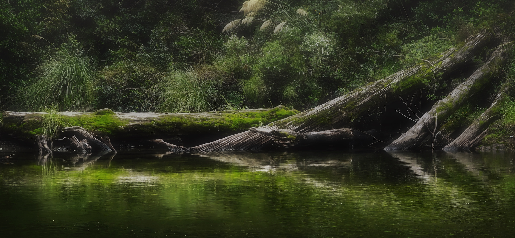
Te Araroa trail section: After a long road walk, follow the emerald green waters of the Pelorus River, then head up, along and over the scenic Bryant Range.
From Pelorus Bridge, there is a 14km road walk along Maungatapu Road (also known as Mt Richmond Road) to the Pelorus River Track trailhead. Initially the road is sealed and passes through farm land. Later it is unsealed and has exotic and indigenous forest sections.
Note: There are no budget accommodation options along this road - the Pelorus Bridge campground should be used.
Pelorus River Track
Starting from the end of Maungatapu / Mt Richmond Road, the Pelorus River Track is a long-established DoC tramping track with a good hut system. The track joins directly with Te Araroa’s next section, the Richmond Range Alpine Track, at Hacket Junction. Both these tracks are within the 165,946 hectare Mt Richmond Forest Park and for logistical reasons many trampers will prefer to walk them consecutively as a single 9 (or more) day tramp. This is a major undertaking for which fit trampers should come well prepared. The larger rivers are bridged but the tramp involves many stream crossings that may be impassable after rain. Mt Richmond Forest Park contains a mixed variety of beech and podocarp forest, including the finest rimu along Te Araroa.
Road End to Captain Creek Hut - 8.5km / 4 hour
The track follows the Pelorus River for about a 1 hour to the Emerald Pool picnic area. From here the track climbs upwards. It leaves the river, sidles, and then returns to the river. The 6 bunk Captain Creek Hut is still about 30 minutes further upstream from here.
Captain Creek Hut to Middy Hut - 5km / 2 hour
This undulating section crosses Captain Creek by swing bridge after leaving the hut near its confluence with the Pelorus River. Beyond Captain Creek, swing bridges take trampers across the Pelorus River, and later Fishtail Stream.
Beyond Fishtail Stream the track leaves the Pelorus River then returns to it for the final stretch to Middy Hut (6 bunks).
Middy Hut to Rocks Hut - 5km / 3 hour
From Middy Creek Hut (6 bunks) cross a swing bridge and then climb for 20 minutes to a junction where the Pelorus Track branches to the left. The Rocks Track (to the right) climbs steadily from the junction for about 600m up a broad ridge. It then enters an area with many hummocks and rock outcrops, turning northwards and meeting the Bryant Range near the 16-bunk Rocks Hut.
Note for NZTopo map users. The NZTopo50-BQ26 Nelson map for this region correctly shows Te Araroa leaving the Pelorus Track after Middy Hut and climbing to Rocks Hut. If you are using a phone Topo app or DOC web page to follow Te Araroa and you zoom out far enough the base map will switch to NZTopo250-13 Nelson which incorrectly show the older route, continuing along Pelorus Track via Roebuck Hut to rejoin Te Araroa at Totara Saddle. This route is viable but less frequently used.
Rocks Hut to Browning Hut - 11km / 4½ hour
From Rocks Hut, this track wanders through a landscape of rock outcrop and hillocks. It then climbs over several high points before beginning its descent towards Tōtara Saddle.
The trail emerges onto an open patch of tussock land associated with the mineral belt, an interesting ultramafic rock zone where you notice the vegetation changes drastically, for 15 minutes or so before re-entering the forest and descending - steeply in places - to Tōtara Saddle. From the saddle, the track descends steeply to Browning Hut (8 bunks).
Browning Hut to Hacket Junction - 3.4km / 1 hour
(Plus another 5.7 km or 2 hours out to the Hacket Picnic Area Carpark on Aniseed Valley Road for those finishing this section there).
This is a straightforward section with all intersections well signposted. There is a high/low water track option at one point but this is a bit meaningless as you'll get wet boots in subsequent stream crossings whichever route you take.
Flooding after heavy rain in September 2022 has deposited silt and rubble into the stream, raising the stream bed. This in turn makes the low water track subject to flooding so the high water track is the better option.
At Hacket Junction trampers have the option of continuing on the next Te Araroa section to Hacket Hut, Starveall Hut and beyond or finishing their tramp at the Hacket Picnic Area Carpark. Private transport arrangements are best made in advance if you wish to end your tramp here. Failing which it is a 12km road walk down Aniseed Valley Road to Hope village where a bus can be caught into Nelson.
Conditions
Potential hazards
- Vehicles on road or track on Maungatapu Road
- River crossings - Never cross flooded rivers
How to get here
Northern Start: Junction of Maungatapu Road and SH6, Pelorus Bridge
Southern End: Hacket Hut Junction
Transport
Pelorus - Getting there/away
- Private Driver Hire - P: 0272 565 643 (Paul) - can transport to/from all locations Picton-Anakiwa-Pelorus Bridge-Nelson-St Arnaud, priced on enquiry. We can take you from Anakiwa to the start of the trail head for the Pelorus track at the end of Maungatapu road, including stopping to re-supply in Havelock en-route. Travel time just under 2 hours including time to re-supply. This saves almost 3 days of road walking
Hope to Nelson - Getting there/away
- InterCity - P: 03 365 1113
- Private Driver Hire - P: 0272 565 643 (Paul) - can transport to/from all locations Picton-Anakiwa-Pelorus Bridge-Nelson-St Arnaud, priced on enquiry.
Accommodation
Pelorus
-
DOC Pelorus Bridge Campground - 5949 State Highway 6, Main Rd, RD2 - P: 03 571 6019 - E:sarah.huntley@ngatikuia.iwi.nz - Serviced campground.
-
Campground office is open with limited hours as follows - 8:00am-8:30am and 1:30pm-6:00pm during weekdays, and 11:00am - 4:00pm on Saturday and Sunday. You can register for a campsite on the DOC website and a green tag will be waiting for you at the office. Fees: $20-22 per might. The Campground is not covered by the backcountry hut pass, so you must pay on arrival or when you book online. Bounce boxes are welcome for a fee of $10.
- Te Hoiere/Pelorus River runs alongside the campground and is a beautiful spot for a swim. Please do not use any soap/shampoo if bathing in the river (or any rivers along the trail) as this contaminates the water and can harm aquatic life.
- Pelorus Bridge Cafe is currently closed. Re-opening is expected in 2024
-
Hope
From Hope it is 29km to Nelson via Richmond. Nelson and Richmond are full-service towns.
- The Pear Orchard Lodge - (BBH) self-catering lodge - max. 20 people - 569 Hill Street South, Hope - P: 03 544 5361 - E: stay@thepearorchard.co.nz - Rooms range from dorm to private rooms with ensuite - pickups from Hacket picnic area with prior arrangement
- Aniseed Valley Cottages - Aniseed Valley Rd (near Hacket picnic area) - P: 03 544 3144 - pickup available from Hacket Picnic Area and (for a fee) guests can be transported to Richmond/Nelson for resupply
Food And Supply
Nelson
- MD Outdoors - Wakatu Carpark, Unit 4/126 Trafalgar Street, Nelson 7010- P: Emily Russell +64 27 606 7977 - Camping, tramping, climbing, trail running, packs, sleeping bags, tents, shoes, socks (including injinji), poles, cooking... all the gear
Hope
- Hope Store and Takeaways - 205 Main Rd, Hope - P: 03 544 9803 - Takeaway meals and light resupply available.
Track Elevation and Map


Total 1 photos. Click image above to view them all.
More information
Before starting Te Araroa either as a through-walker of the whole country or a section walker, please register on Te Araroa website. Please also visit the website or download the app for detailed maps, trail alerts and other relevant information.
We encourage you to continue gaining the skills and knowledge required for a safe trip. The NZ Mountain Safety Council has lots of free resources and information you can use. These can be accessed via www.mountainsafety.org.nz.
We recommend trying these online learning tools:
Additionally, check out the range of helpful videos available from the NZ Mountain Safety Council YouTube channel.

Page last updated: Mar 6, 2024, 4:27 PM