Mangatāwhiri to Mercer
-
Walking
Te Araroa section: Follow the Mangatāwhiri River past Dutch-style polders to connect with historic Mercer, where the first invasion of the Waikato took place. Finish on the banks of the Waikato River.
Follow SH2 east for 2 km keeping well off the road shoulder as this is an extremely busy road with a lot of traffic.
UPDATED 9th October 2023 Map 34, from the 2023-24 v42 set, shows an incorrect crossing point. Previous Trail Notes are also incorrect. The correct crossing point for southbound walkers is 330 metre further downstream, as highlighted below. Apps that have not been updated may continue to show the incorrect crossing point.
- SOBO: turn right from State Highway 2 onto Serpel Road, and in 350 m enter through a farm gate on the left and follow the line of trees to the farm track. Walk along the farm track and in 620 m turn left at the track junction, then right in 140 m and follow the track for another 450 m to its junction with Dobson Road. Turn right onto Dobson Road and follow the orange TA markers 1.8 km to the Mangatawhiri River stopbank. Turn right and follow the stopbank 330 metres downstream to the crossing point, a concrete power pole across the riverbed. It’s marked on both ends by a steel post carrying a large orange track marker, and at this point the river has a gravel bed. If you’re unable to cross the river due to high water levels, follow the stopbank 2.8 km upstream to State Highway 2. Carefully cross then walk under the road bridge to join the other stopbank, and follow that back downstream to the crossing point.
- NOBO: Walk upstream on the Mangatawhiri River stopbank until the crossing point, marked on both ends with a steel post carrying a large orange track marker, where the river has a gravel bed. If you’re unable to cross the river due to high water levels, continue along the stopbank for 2.8 km to State Highway 2, carefully cross the road bridge, and walk along State Highway 2 for 3.6 km to rejoin TA at the junction with Serpel Road. If you can cross the river, climb the stopbank and follow it 330 metres upstream to the farm track. Follow the TA track markers along the farm track (which becomes Dobson Road) for 1.8 km to a marked farm gate and farm track on the left. Follow the track for 450 m to a left turn, then follow it for 140 m to a right turn. Continue along the track for 620 m and follow a line of trees until you reach a farm gate that enters onto Serpel Road. Follow Serpel Road for 350 m and turn left onto State Highway 2. State Highway 2 is one of New Zealand’s busiest roads, especially on Friday afternoons and weekends, so be very careful crossing and walking along it.
Mangatawhiri River Track — 4km / 1 hour 15 minutes
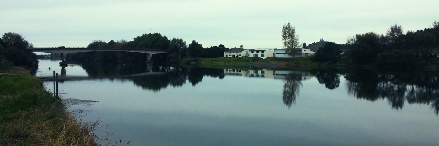
This track opens up a little-seen corner of New Zealand where you’ll overlook the stopbank, a Dutch Polder-style agriculture. It follows the Mangatāwhiri River from the 2.5 km below the SH2 bridge, southwest to the exit at McIntyre Road.
Follow the stopbank, which is on the true left of the Mangatāwhiri River – that is, the left bank as you face downstream. One low-lying area about halfway along may flood, but only after heavy rains. After a 2.5km walk down the stopbank, you’ll come to a drainage ditch about 10m wide. At this point, the stopbank and the track route turn left at a right angle and follow the drainage ditch inland for about 1km before finishing at the McIntyre Road end. A pump station is there for an Archimedes Screw, which is part of the drainage.
If you want to see what this land was like before being modified, look across the drainage ditch, and you’ll see the natural swamp run by the Auckland/Waikato Chapter of Fish and Game.
- Note: After heavy rain and when the river is running high, this route may be underwater — check conditions carefully, and if the water is high, use Koheroa Roa from SH2 to Mercer as an alternative.
Mercer — 4.5km / 1.5 hours
McIntyre Road is a little-used road serving only a few houses. It has views across the Fish and Game swampland and a relaxing shady section before it reaches the junction with Kellyville Road.
After crossing the railway line, follow the markers into the trees opposite and under the Southern Motorway bridge.
Turn left/south and follow the marked route parallel to the motorway 1.5km to the Mercer Service Centre — where a petrol station, cafe and food court are available for refreshments before you leave the Auckland region and enter Waikato.
Conditions
Potential hazards
- Vehicles on road or track
- Farming operations Occasionally farm animals. Also temporary electric fences (can be stepped over).
- Open drains
- Track exposed to sun, wind or cold
- Few water sources
No dogs allowed
How to get here
Northern Start: End of Lyons Rd, Mangatawhiri
Southern End: Skeet Rd, Mercer
Transport
The Auckland region conveniently ends at the Mercer Service Centre, SH 1, Mercer.
It is well serviced by long haul bus companies such as:
- InterCity - P: 09 583 5780 - E: info@intercity.co.nz
- Northliner Express Coach Service - P: 09 307 5873
Accommodation
- Mercer Motel - 2 Roose Rd, Mercer - P: 09 233 6555 - E: info@mercermotel.co.nz - Newly renovated motel units from $145 per night, there are also cabins for $75 pp and camping is $20 per night for one person and $30 for two people. For camping, check in with the team at Mercer Landing and they’ll direct you.
Food And Supply
- Mercer Landing Kitchen & Bar – 6 Roose Rd, Mercer – P: 09 236 8641 – Newly renovated restaurant and bar. Open Wednesday-Sunday 10am-Late, with coffee and pastries available for takeaway from 7am daily. Packed lunches available upon request.
Track Elevation and Map


Total 1 photos. Click image above to view them all.
More information
Waikato trail notes, including information about accommodation, transport and resupplying
Before starting Te Araroa either as a through-walker of the whole country or a section walker, please register on Te Araroa website. Please also visit the website or download the app for detailed maps, trail alerts and other relevant information.
We encourage you to continue gaining the skills and knowledge required for a safe trip. The NZ Mountain Safety Council has lots of free resources and information you can use. These can be accessed via www.mountainsafety.org.nz.
We recommend trying these online learning tools:
Additionally, check out the range of helpful videos available from the NZ Mountain Safety Council YouTube channel.

Page last updated: Nov 24, 2023, 2:30 PM