
East Ahuriri Track
-
Walking
-
Dog Friendly
Te Araroa section: the East Ahuriri Track is a gem and provides a good transitional tramp for moderately experienced trampers looking to go the next step, off the heavily used and well-groomed tracks where they’ve learned their craft and onto Te Araroa’s more remote and demanding sections.
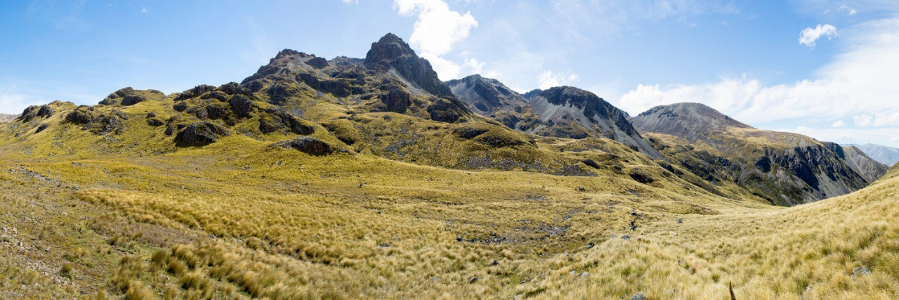
The track climbs 800m from Lake Ōhau over the Ōhau Range to the Ahuriri River. This is through the Ruataniwha and Ahuriri Conservation Parks. The track has no obvious ground trail for long stretches and the markers are often distant.
The track starts on the 4WD drive track next to Glen Mary Ski Club and climbs to join with the marked A2O cycleway, which traverses across to Sawyers Creek and beyond to Freehold Creek.
Once at Freehold Creek, follow DOC markers up through the beech forest. It’s a well-marked and clearly formed track to this point – a good day walk for anyone wanting a return trip from the Ski Club.
Beyond the treeline, the track initially follows the poles and light ground trail towards Dumb-bell Lake. This is on the true right of Freehold Creek. The East Ahuriri Track peels off this track in a southwest direction, and from here, there are regular poles (though they are not always visible from one to the next) along the east side of the swamp. The poles continue on this line until the beginning of the descent into East Ahuriri. Descend with care to the East Ahuriri River.
From here, travel is downstream by the most practical route. There are a few river crossings, but these are straightforward in normal flows.
The track climbs and sidles above the true right bank when it needs to avoid two gorged sections. Along the way, a two-bed hut becomes visible in the distance on the true left side of the river. The going becomes easier as the river opens up lower down.
Quailburn Hut on the true left of the East Branch of the Ahuriri River at km 2522 is owned by DOC but is not maintained. Accommodation is rudimentary but may be welcome in adverse conditions. 9 km before the Ahuriri River Crossing
There is some limited camping shelter afforded by trees at km 2527.8, 4 km before the Ahuriri River Crossing
The track reaches the first line of pine trees as it emerges into the wider Ahuriri Valley. There are more pine trees further along as you continue straight ahead towards the Ahuriri River, which, in normal flows, is the largest unbridged river on Te Araroa in the South Island.
Camping is usually possible on the grass flats at km 2530 before the river crossing
Follow the fence down to the Ahuriri's bank and look across for the track markers on the other side. They continue about 50m downstream from the 4WD track that cuts down the far bank. Once you’ve identified this spot, it’s time to look for a safe place to cross the river.
- Note: If the Ahuriri cannot be forded safely, continue downstream for about 5km to the Ireland Road Bridge. This provides the bailout option. It is then about the same distance back up Birchwood Road to the trailhead.
- It is not possible to follow the riverbank closely all the way to the Ireland Road Bridge as the river cuts close to the steep bank. If you are walking to the bridge to avoid the river crossing, it is necessary first to climb the bank away from the river and then walk between the private pine forest and the steep bank. This requires care as the cliff edge is unstable in parts. This is a difficult walk, and it is best not to attempt it late in the day.
From the far side of the river, the track follows marker poles straight up the steep bank. The track then turns left and follows the top of the river bank to the next fence line, which marks a right-hand turn and the final walk out to the carpark on Birchwood Road.
Conditions
Potential hazards
- River crossings - Never cross flooded rivers
- Small stream crossings
- Track exposed to sun, wind or cold
How to get here
Northern Start: Glen Mary Ski Club, Lake Ohau Road
Southern End: Birchwood Road carpark, Ahuriri Valley
To exit to Omārama, go left 11.2km to SH8, then left again for a further 17.4km.
Transport
Accommodation
- There are no official DOC huts between the shore of Lake Ohau and Top Timaru Hut, a distance of 50 km, including a major river crossing. Possible breaks are described in the text below.
- Quailburn Hut (basic, unmaintained) km 2522
- Camping near trees beside the East Branch of the Ahuriri River, km 2527.8
- Camping on the Ahuriri River flats immediately before the river crossing. km 2530
- Tin Hut (Privately owned, $10 for Te Araroa hikers) 10.5 km beyond the river crossing, at km 2542.4
- Top Timaru Hut is at km 2555.7
Food And Supply
Track Elevation and Map

Total 1 photos. Click image above to view them all.
More information
Before starting Te Araroa either as a through-walker of the whole country or a section walker, please register on Te Araroa website. Please also visit the website or download the app for detailed maps, trail alerts and other relevant information.
We encourage you to continue gaining the skills and knowledge required for a safe trip. The NZ Mountain Safety Council has lots of free resources and information you can use. These can be accessed via www.mountainsafety.org.nz.
We recommend trying these online learning tools:
Additionally, check out the range of helpful videos available from the NZ Mountain Safety Council YouTube channel.

Page last updated: Aug 30, 2023, 10:57 AM