Coast To Coast Walkway
-
Walking
Te Araroa section: The Auckland isthmus is New Zealand’s narrowest neck of land, never more than 9km from north to south and less than 2km east to west. Given the distance, Māori used these as canoe portages, from the Waitematā Harbour and the Pacific Ocean on one side, to the Manukau Harbour and the Tasman Sea on the other.
Please follow the map and signage in exploring the Auckland isthmus. Proceed roughly as follows:
- Cross Quay St onto Queen St
- Customs St East
- Emily Place
- Princes St
- Auckland University
- Alfred St
- Grafton Rd
- Auckland Domain
- Auckland War Memorial Museum (adjacent to the route)
- Park Rd
- Mountain Rd
- Clive Rd
- Mt Eden Domain
- Owens Rd
- Cecil Rd
- Epsom Ave
- Through the Auckland College of Education
- St Andrews Rd/Melville Park
- Cross Gillies Ave to Kimberley Rd
- Cross Manukau Rd and park to Pūriri Drive
- Cross Greenlane West Rd to Cornwall Park
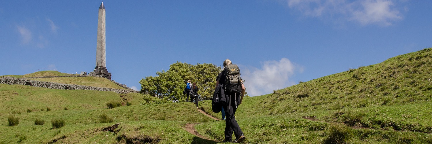
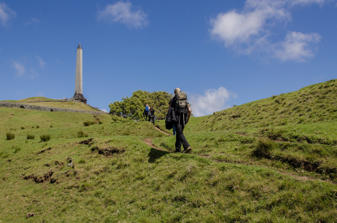
- Pōhutukawa Drive and Olive Grove and up to One Tree Hill summit
- Exit onto Haydn Ave, then onto Manukau Rd, and south through the Royal Oak roundabout
- Continue on Manukau Rd (this leaves the Coast to Coast Walkway temporarily) and through Jellicoe Park
- Grey St
- Quadrant Rd
- Arthurs St, and down a green corridor
- Onehunga Bay Reserve, across the bridge to Orpheus Drive
- Walk east along the path to cross the new pedestrian bridge to Mangere
The Isthmus
Auckland has long been known as Tāmaki Makaurau — "the spouse desired by a hundred lovers.” All who saw it for its fertile volcanic slopes, sheltered fishing sites, and access to the greatest waterway in New Zealand, the Waikato River, desired it.
The Coast to Coast walk takes you through landscapes shaped by 600 years of Māori occupation and through some of our finest natural and built heritage areas — woodland settings, windswept hills, charming parks and gardens, captivating architectural treasures, and fascinating geological landforms — all offering glimpses of times gone by.
You will also experience panoramic views stretching across Auckland city and the region. Most impressive is the vista of Auckland’s waterfront playground, the Hauraki Gulf, including the distinctive cone shape of Rangitoto Island.
Trail viewpoints also show:
- To the North - the waters of the Waitematā Harbour, the islands of the Hauraki Gulf and the 600-year-old symmetrically-shaped shield volcano, Rangitoto.
- To the Northeast - an old volcanic chain, the Coromandel Range.
- To the East - the uplifted greywacke bulk of the Hunua Ranges.
- To the South - the more gentle rise of the Bombay Hills, another old volcanic field.
- To the West - the remnants of a once-mighty volcanic chain, the Waitakere Range.
- To the Southwest - the vast Manukau Harbour.
The Urban Landscape
A warm climate, good rainfall and generous property sizes have encouraged an urban forest of mixed native and exotic trees with gardens at their feet. Street and park plantings date back to the 19th century. The oaks, often grown from acorns from English estates, and the plane trees brought from London reflect the colonial heritage. The distinctive pinnate shape of the Norfolk pines reflects Auckland’s sea-route beginnings - brought to early Auckland in tubs and sold by sailors. Many native trees also prevail in the parks.
The city’s early merchants built grand verandah villas on Princes Street, establishing what would become, alongside the later bungalows, a prevailing architectural pattern.
Native birds include the iridescent blue kingfishers (kōtare), fantail (pīwakawaka), and tui - distinguished by a white throat tuft and a melodious call, and the large wood pigeon (kererū).
Whau trees, whose wood is as light as balsa and were once used by Māori for net floats, still grow on Maungawhau (the hill of the whau tree). The trail passes a small forest of Tōtara and Rimu on the old volcano’s southern slopes, and Cornwall Park’s many native trees include an avenue of Pūriri, which the trail follows, and a young kauri grove. You will find introduced bird species en route, including the sparrow, blackbird, thrush and rock pigeons in the parks. Sizeable grassy areas attract the large black and white magpie and the bright green and red rosella, both introduced from Australia.
Conditions
Potential hazards
- Vehicles on road or track Take care crossing roads - use crossings where possible
- Farming operations Take care around livestock in Cornwall Park
Dogs on leash only in Cornwall Park.
How to get here
Northern Start: Ferry Terminal, Quay Street, Auckland CBD
Southern End: Onehunga Bay Reserve, Beachcroft Avenue
Transport
- Auckland Transport for bus or train information
Accommodation
There is a wide variety of accommodation available throughout this section including Te Araroa preferred hostels in Auckland CBD:
- Econo Lodge City Central, 37 Wellesley St - P: 09 307 3388
- Metro Adventurer Backpackers, 51 Hobson St - P: 800 112 128
- Base Backpackers Auckland, 229 Queen St (entrance on Darby St) - P: 09 358 4877
- Brown Kiwi Hostel, 7 Prosford St - P: 09 37 0191
- Frienz Backpackers, 27/31 Victoria St East - P: 09 307 6437
- Nomad Auckland Backpackers, 20 Fort Street - P: 09 300 9999
- Queen Street Backpackers, 4 Fort Street - P: 09 373 3471
Detour to Newmarket Shopping Centre
Includes a range of shops, supermarket, cafes, banks, pharmacies
Detour to Onehunga Shopping Centre
Includes a range of shops, supermarket, cafes, banks, pharmacies
Food And Supply
Track Elevation and Map

Total 2 photos. Click image above to view them all.
More information
General information and map
- Auckland Council walking tracks information
- DOC Visitor Centre, Shed 19, Princes Wharf - adjacent to "The Crab Shack" and overlooking the ferry terminal. Backcountry Hut passes, booking advice and plenty of information and advice available.
Places to visit
- Auckland University
- Auckland Domain
- Auckland War Memorial Museum
- One Tree Hill and Cornwall Park
- Stardome Observatory
Before starting Te Araroa either as a through-walker of the whole country or a section walker, please register on Te Araroa website. Please also visit the website or download the app for detailed maps, trail alerts and other relevant information.
We encourage you to continue gaining the skills and knowledge required for a safe trip. The NZ Mountain Safety Council has lots of free resources and information you can use. These can be accessed via www.mountainsafety.org.nz.
We recommend trying these online learning tools:
Additionally, check out the range of helpful videos available from the NZ Mountain Safety Council YouTube channel.

Page last updated: Sep 29, 2023, 9:06 PM