
Photo by
Kiwi-Wings
Te Araroa trail section: After completing the Queen Charlotte Track, follow the Link Pathway beside tranquil inlets, through forest and farmland, passing through Havelock, the Green Shell Mussel Capital of the World!
This next section of Te Araroa is maintained by a local group whose project, the Link Pathway, is a 42km walking and cycling trail linking Picton to Havelock with a side trail to Anakiwa. Anakiwa is the small village at the southern end of the Queen Charlotte Track. Te Araroa signage will come in due course, but for now, walkers can follow the numerous Link Pathway signs. Take in the impressive views of the Marlborough Sounds and native bush as you follow this community-built path.
The Link Pathway heads out from Anakiwa to the T junction with Queen Charlotte Drive, turn right and continue to Linkwater School some 1.25km distant.
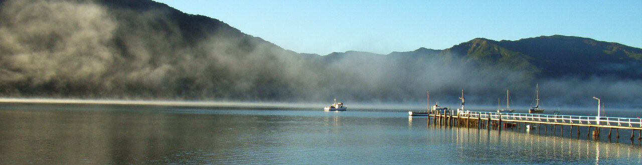
From the school, continue on Queen Charlotte Drive past the Linkwater Service Station. At the end of the Linkwater straight, follow the trail around the Mahakipawa Arm to the next stretch of bush track leading off from the right-hand side of the road. The Link Pathway will take you all the way around the point and into Havelock — a triumph of community vision and energy.
Continue following the Link Pathway crossing the Havelock Causeway Bridge, then a series of beautifully constructed boardwalks will take you across the estuary and up through the historic Havelock Cemetery. Continue on the footpath to SH6, turn right and walk the remaining 100m into Havelock Village.
From the shopping area on Havelock Main Street (SH6), walk west on the footpath and then the road shoulder. 2.5km from the northern edge of Havelock, turn right/west into Te Hoiere Rd. Cross the bridge and continue 1km on Te Hoiere Road, crossing another bridge and reaching Kaiuma Bay Road. Turn left into Kaiuma Bay Road and walk some 9.5km to Daltons Bridge and the start of Daltons Track.
Daltons Track opened in March 2011 following a collaborative process involving the Te Araroa Trust, private landowners, DoC, Marlborough District Council, and Herenga ā Nuku (Outdoor Access Commission).
When you reach Daltons Bridge, the large sign and stile onto Daltons Track will be immediately in front of you at the intersection of Kaiuma Bay Road and Daltons Road laneway - cross the stile, walk over towards the river and follow Daltons Track following the orange triangles.
Te Araroa Trust gratefully acknowledges the generosity of the two landowners allowing us access on to their land. To ensure ongoing goodwill, please respect the following conditions of access:
The track is to tramping track standard. It has a natural grassed surface, stiles over fence lines, and several unbridged creek crossings, which are straightforward in normal flows.
Daltons Track follows the true left bank of the Pelorus River for 6.5km. The route follows the fence line adjacent to (beside) the Pelorus River, and at no time does it follow the farm road / laneway, so, to repeat, please do not use that under any circumstances.
Continue following the orange triangles through the paddocks, the trail then enters the DoC Pelorus Bridge Scenic Reserve. This well marked loop track can be followed in either direction (15mins one way or 20mins the other way) to a swing bridge over the the sparkling Rai River, just before the confluence with the gorgeous Pelorus / Te Hoiere River. It then emerges through the forest at Pelorus Bridge, 100m from the DoC Campground, where there is parking and public toilets.
The stunning green waters of the river pools may tempt you for a dip on a hot day. Otherwise, Maungatapu Road (also known as Mt Richmond Road) lies in front of you, and Te Araroa continues south on that to the Pelorus River track trailhead.
Northern Start: Northern end of Anakiwa Road, Anakiwa
Southern End: Junction of SH6 and Maungatapu Road, Pelorus Bridge

Total 1 photos. Click image above to view them all.
