42 Traverse
-
Walking
-
Mountain Biking
-
Horse Riding
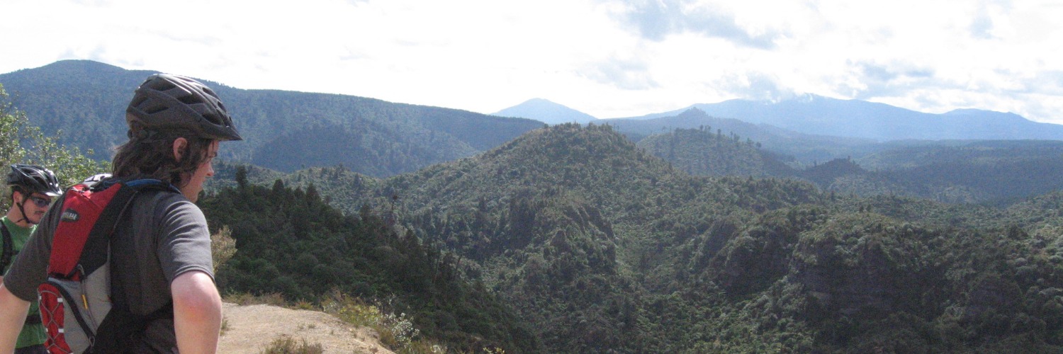
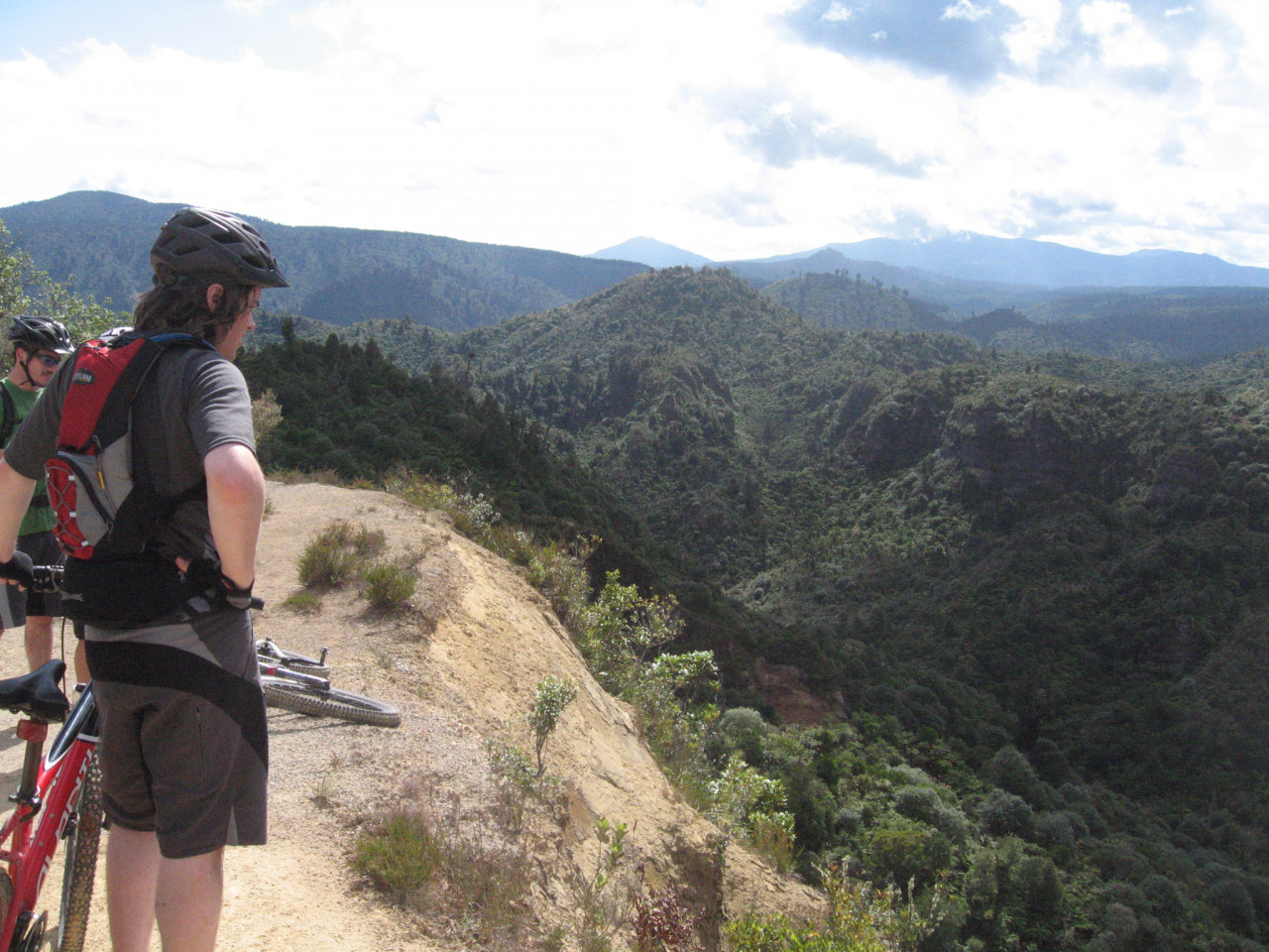
Te Araroa trail section: The 42 Traverse is a 46 km multi-use track through the Tongariro Forest Conservation Area. It is one of the best challenging mountain biking tracks in the North Island. It is also a stunning walk for Te Araroa walkers and other trampers.
From Hākiaha Street (SH4) in Taumarunui, head south (Turaki Street and Morero Terrace) to cross the Whanganui River and get onto Hikumutu Road for a long but pleasant walk through the countryside. Follow Hikumutu Road through the small settlement of Hikumutu, past a brief encounter with the Whanganui River, then east to Ōwhango. You’ll join Kawautahi Road just before you get to Ōwhango, then follow that east 1km to SH4. Then walk north 200m on SH4 and turn right/east into Omatane Road on the southern edge of Ōwhango. Follow Omatane Road, Onga Street and Whakapapa Bush Road to the start of the 42 Traverse. It is 27km from Hākiaha Street in Taumarunui to Ōwhango.
The 42 Traverse track, used by Te Araroa between Owhango (km 1069) and the junction with Waione/Cockers Track (km 1092), was previously closed by DoC due to a slip at km 1088.5. DoC have since re-opened 42 Traverse and provided an optional bypass track from km 1083.4 to km 1090. The ground continues to slump but the slip is crossable on foot
42 Traverse (including Waione/Cokers Track) — 35km / 1.5 days
This track follows the 42 Traverse four-wheel drive road for the first 22km. In wet conditions, this can be very muddy and slippery. This branches off along the Waione/Cokers DOC track, then on to Access Road #3 for about 6km before joining SH47. Continue on SH47 northeast; there is the junction with SH46 where there is accommodation. The Waione Track Bypass marked on some maps between km 1100 and km 1102 is no longer necessary
Note, this route previously deviated north from Access Road #3 to visit Te Pōrere Redboubt. However, we now encourage walkers to remain on Access Road 3 to respect this culturally significant site.
A 7.5km road walk from the exit of Access Road #3 to the turnoff for the start of the Tongariro Alpine Crossing (a further 1km up to the carpark) is along a sealed highway, broken only by a small settlement near the junction of SH46 and SH47 that has some accommodation including Tongariro Holiday Park. This is the last comfortable campsite before the Tongariro Crossing.
The next campsite is at DOC’s Mangatepopo Hut, 25 km away. Make sure you have enough water for the crossing before you start. There are no streams on the mountain, and the creek just after Ketatahi Carpark is undrinkable due to its high alkali content.
Although not the official Te Araroa route, it is possible to make a day trip from Taumarunui to experience the Tongariro Alpine Crossing, then kayak/canoe the upper reaches of the Whanganui River to Whakahoro and on to the Pipiriki/Whanganui River
Conditions
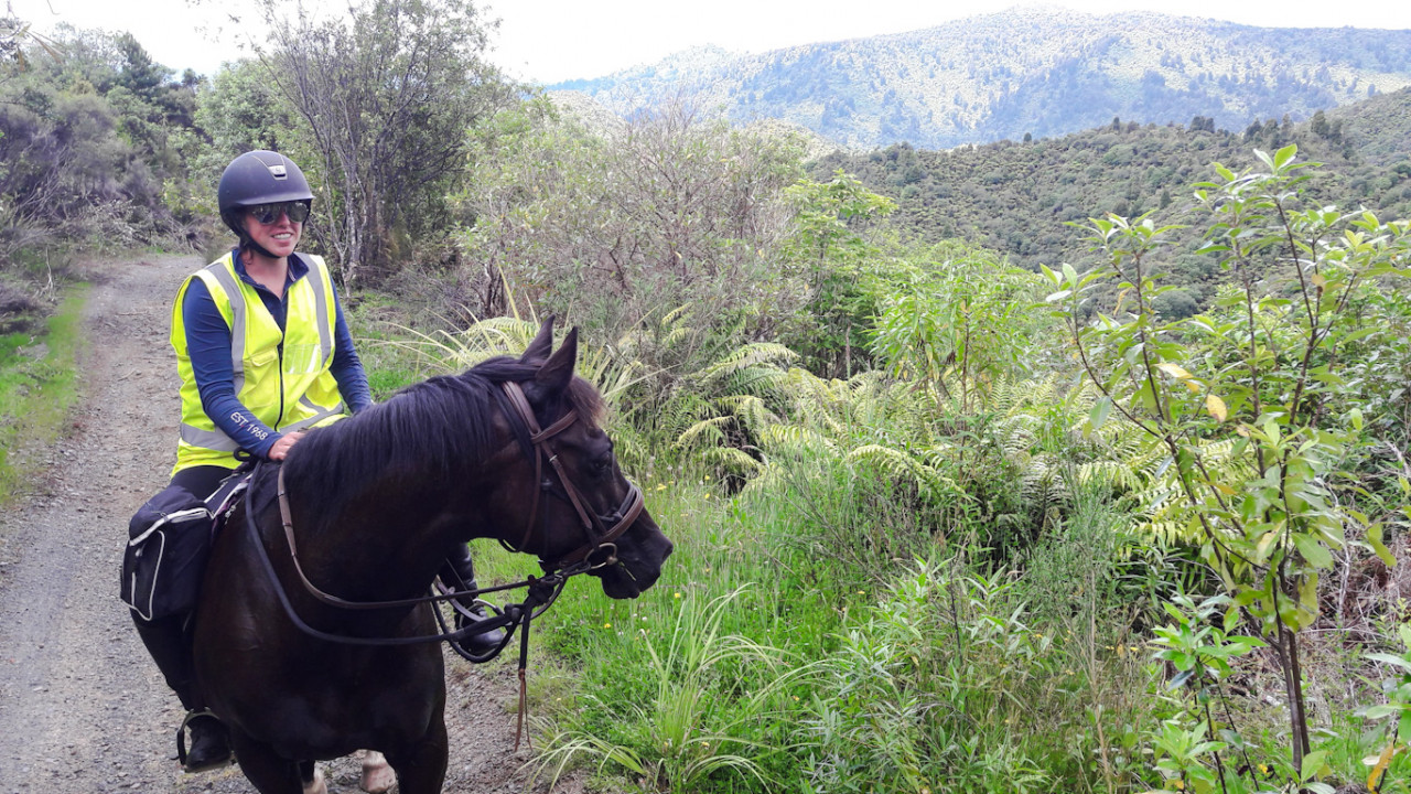
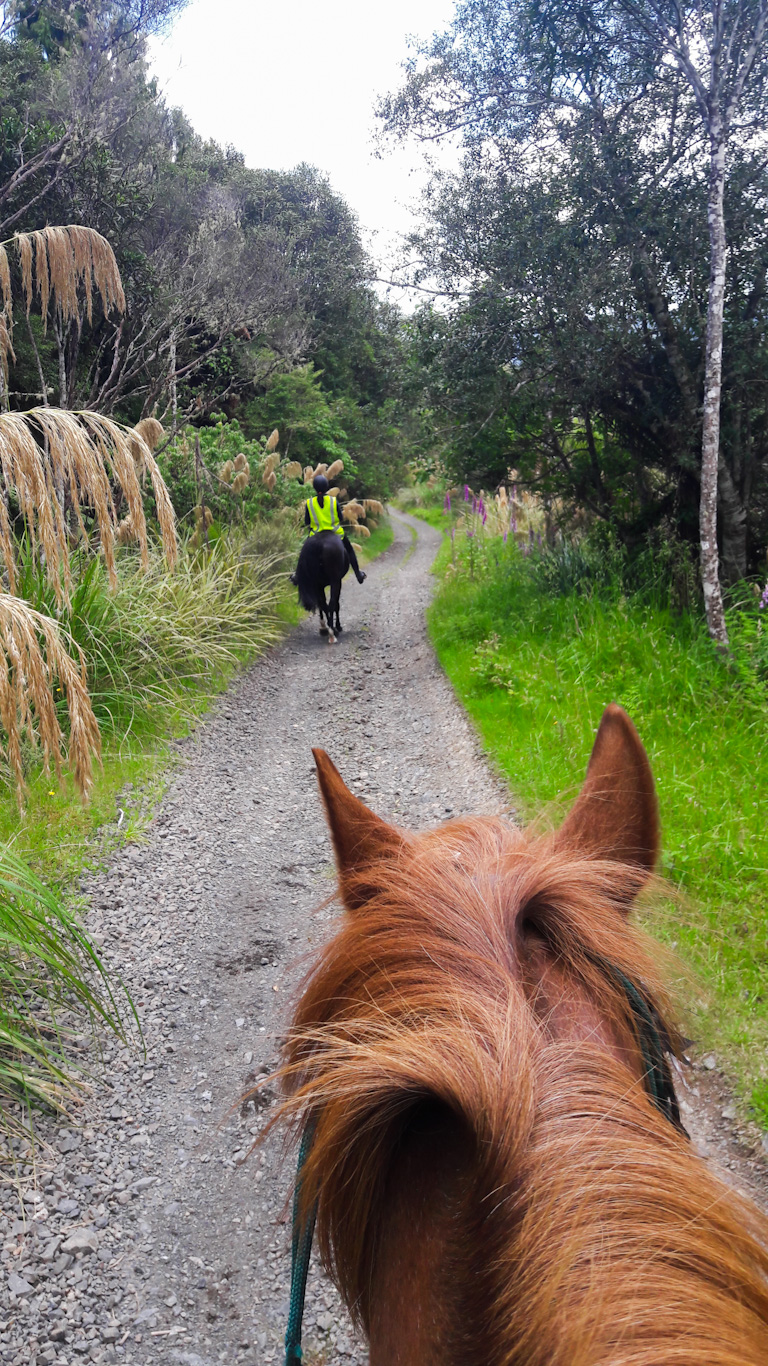
- The 42 Traverse has a variety of users - share the track with care and consideration.
- Take care following rainfall as stream levels rise quickly. Only cross waterways after checking they are safe.
- Dogs with a DOC permit for recreational hunting or management purposes only.
- 4WD vehicles are not permitted from 1 May – 30 November.
- The T42 mountain biking, running and walking event is held annually in early May.
How to get here
About 16 km along SH47 from National Park Village, turn into Kapoors Road. Follow this for about 6 km to the start of the track at the road end.
Transport
There are several shuttle companies providing morning pick-ups from nearby towns and delivery to the track start, i.e National Park, Ōhakune, Tūrangi and Taupō. They include:
- Ruapehu Scenic Shuttles — Ōwhango — P: 020 4111 4648 — E: ruapehushuttle@gmail.com
- Ōwhango Adventures- Ōwhango - Along with canoe hire services and accommodation offerings below, we can help with a variety of tailored transport options in the area for 42 Traverse, Tongariro Alpine Crossing, and Whanganui River. Contact us to see if we can help. P: 0800 2 CANOE/07 895 4854 - E: info@owhangoadventures.co.nz
- Tongariro Expeditions — Shuttle service to the Tongariro Crossing — P: 07 377 0435 E: info@tongariroexpeditions.com (to/from Taupō, Tūrangi, Ketetahi, Whakapapa) — Multiple return times from the northern end of the track (6km from the Holiday Park).
- Dempsey Buses — 25 Seddon Street, Raetihi 4632 — P: 06 385 4022 — info@dempseybuses.co.nz
Accommodation
Ōwhango
- Ōwhango Adventures- free camping, including toilets and free WiFi, coin-operated washing machine, showers. Rooms from $30 pp. Cafe, bar meals. Canoe hire for Whanganui River section: 5 day from Whakahoro to Whanganui for Te Araroa Trail walkers $240 per person across the board. This includes the free night accommodation. 3 day from Whakahoro to Pipiriki - $170 per person across the board. Also includes the free accommodation.
- P: 0800 2 CANOE/07 895 4854 - E: info@owhangoadventures.co.nz[UPDATE 8 November 2023: Meals available Friday nights and certain nights by prior arrangement. Laundry is done off premises until February 2024 so we do not currently have laundry facilities. ]
- Forest Lodge - Omaki Road, Ōwhango - P: 07 895 4458 M: 027 218 4713 - E: reception@forest-lodge.co.nz - backpacker accommodation, camping available
End of route
Tongariro Family Holiday Park - State Highway 47, Tongariro - P: 07 386 8062 - Camping, cabins and units. Highly recommended spot to rest up and recoup between 42 Traverse and Tongariro Alpine Crossing. Halfway point between Taumarunui and National Park
Food And Supply
Ōwhango
- Blue Hill Cafe, Owhango located on the main highway in Owhango next to the mechanics and opposite the public restrooms.
Track Elevation and Map

Total 4 photos. Click image above to view them all.
More information
Before starting Te Araroa either as a through-walker of the whole country or a section walker, please register on Te Araroa website. Please also visit the website or download the app for detailed maps, trail alerts and other relevant information.
This track is part of the Herenga ā Nuku Aotearoa track database. Herenga ā Nuku has maps and advice about public access to the outdoors.
We encourage you to continue gaining the skills and knowledge required for a safe trip. The NZ Mountain Safety Council has lots of free resources and information you can use. These can be accessed via www.mountainsafety.org.nz.
We recommend trying these online learning tools:
Additionally, check out the range of helpful videos available from the NZ Mountain Safety Council YouTube channel.

Page last updated: Apr 3, 2024, 7:27 AM