Select
The select tool is an advanced and powerful way of selecting multiple features from layers simultaneously. These features may then be viewed in the attribute table and exported in multiple formats. It can also be used to select features from layers based on attribute information stored in layer fields (such as area, length, name, ID number, region name etc), rather than by shape or geographic area.
Both of these techniques may be useful for those wanting to get more from Our Maps data, to export the data for research or grouping information by common themes. Or simply selecting layers that coincide with your property boundary, project or outdoor trip.
Selecting by shape
- Turn on the layer(s) you wish to make a selection from
- Open the Select tool from the tool menu
- Click on the Select button dropdown to choose the type of select
- Choose your shape which you will draw to select features by (rectangle in the demo).
- Draw a rectangle over the features to be selected. All features that intersect or are within the rectangle will be selected.
- Selected features will be highlighted in aqua blue.
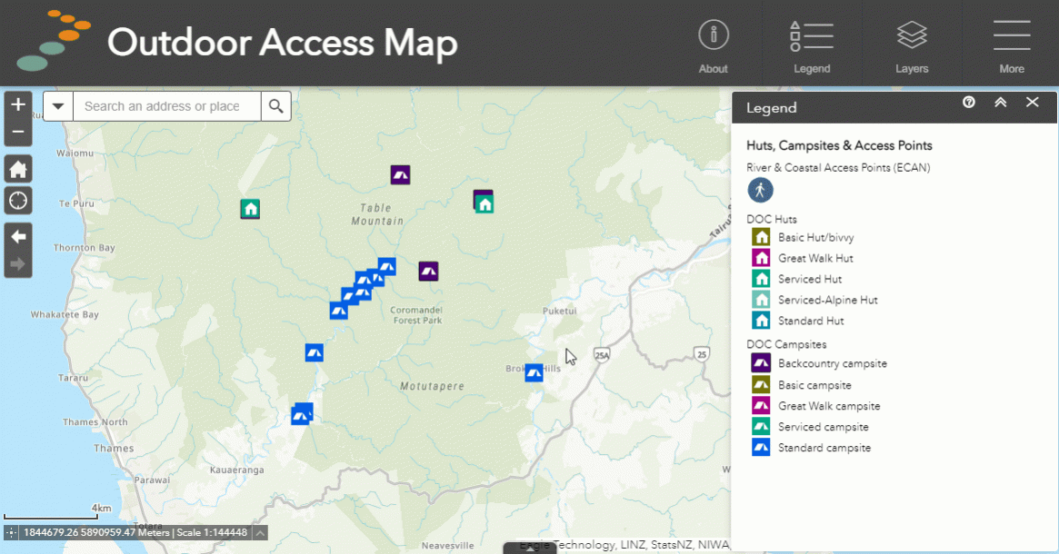
Demo: selecting DOC huts and campsites in Coromandel using the rectangle selector.
Selecting by attributes
- Turn on the layer(s) you wish to make a selection from
- Open the Select tool from the tool menu
- From the Select dropdown menu, choose select by attribute
- Choose the layer you wish to select from - click OK.
- Under filters, click on the settings icon to create a select query.
- Select "add expression"
- Choose the field to be used for the expression from the dropdown
- Choose the type of rule e.g. is, is not, is greater than, contains, does not contain (these change depending on if the field is text or numeric based).
- In the last box, put the text or numeric value to be selected against e.g. For the query Walking & Tramping tracks whose length is greater than 30km, the value is 30.
- Then select OK to confirm the query
- Select OK again to run the query and select qualifying features
Demo: selecting walking & tramping tracks with a length greater than 30km, using the select by attributes feature.
Further options
After selecting your features using either the select by shape or attributes tool, you can perform a number of different tasks by clicking the "three dots" menu next to the layer in the select tool. A few of the most useful are listed below along with their function:
- Zoom to - zooms the map in on your selection.
- Pan to - centers the map onto your selection.
- Show pop-up - open the pop-up for the selected feature(s).
- Export to CSV file - exports all selected features to a CSV file for viewing externally.
- Export to feature collection - exports all features to GeoJSON. This can be imported later into the drawing tool if needed.
- Export to GeoJSON - exports individual selected files to individual GeoJSON files.
- Create layer - creates a sub-layer of the selected features which can be turned off and on in the layer list.
- View in the attribute table - allows the the features to be seen in the attribute table.
- Export to GPX - exports files to GPX for use with GPS devices (for best results use line or point locations only and export one feature at a time).
- Export to KMZ - exports files to KMZ for use with Google Earth.
- Clear selection - removes selection.
For more information on using GPX files with GPS units and Our Maps, check out our handy guide below.
Or