
About our maps
Our maps show public access areas; places where the public has a legal right to access land such as coastline, rivers, conservation land, private land, or parks and reserves. They also show a variety of property information, hunting and fishing spots, and outdoor recreation information, such as walking trails, horse riding, cycle routes, and mountain bike tracks.
You can view all layers against a variety of detailed basemaps such as the LINZ Topographic basemap, aerial/satellite imagery and multiple simplified vector basemaps.
We provide these maps free for anyone to use. One of our statutory functions under the Walking Access Act 2008 is "compiling, holding, and publishing maps and information about land over which members of the public have walking access".
To learn about each of our public access maps in more detail and what you can use them for, see each map below.
Learn about each of our Maps
- Public Access Map
- Property Information Map
- Hunting and Fishing Map
- Tracks and Trails Map
- Outdoor Access Map
Public Access Areas Map
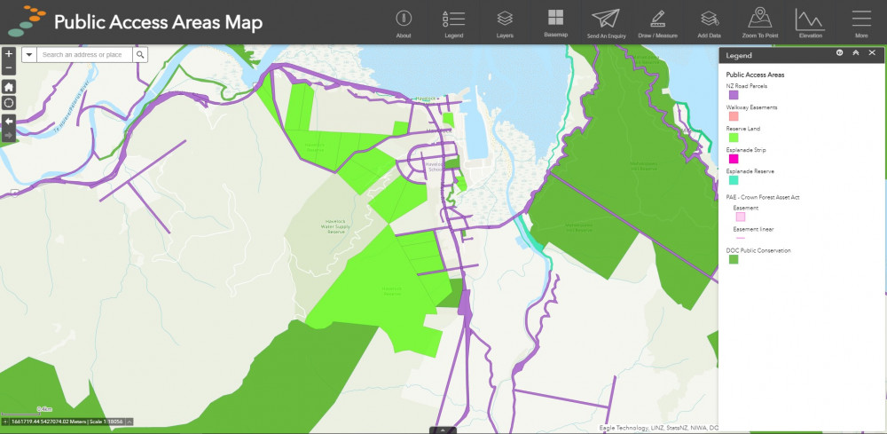
The Public Access Areas Map displays the Walking Access Commission's primary dataset: Public Access Areas (PAA). This shows where the public has a legal right to access. However, it's important to note that not all legal access is physically or practically accessible or always open. For example, many unformed legal roads (otherwise known as paper roads) are physically impractical and some public access easements provide for closure for health and safety or farming reasons.
This data includes NZ Road Parcels, DOC Public Conservation Land, Reserves, Esplanade Reserves and Public Access Easements. For more information on the PAA, see our data page.
Uses
- Viewing legal public access areas across NZ
- Creating PDF maps, including drawings and annotations
- Uploading and visualising GPS data
- Finding locations via coordinates
- Viewing satellite/aerial imagery, topographic and simplified basemaps
Property Information Map
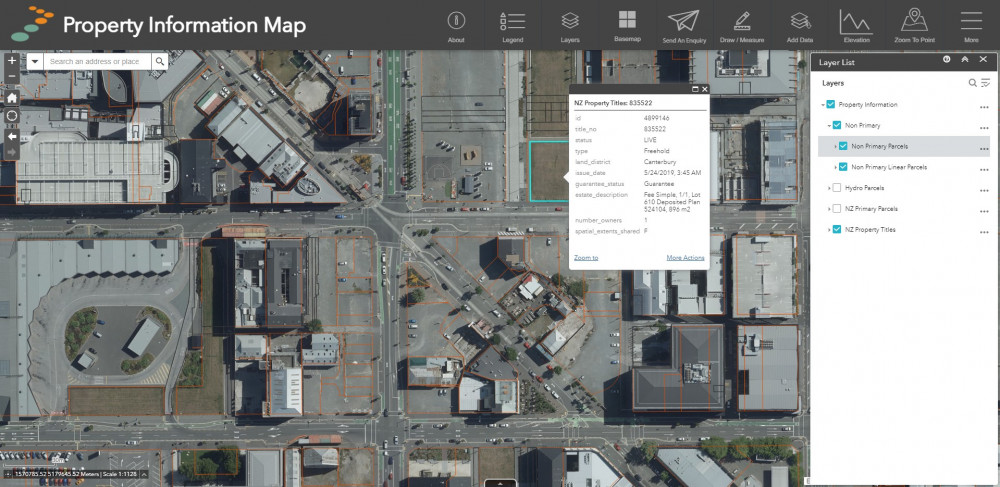
The Property Information Map displays property boundary and cadastral information for the entire country. This enables users to look up primary and non-primary parcels (such as easements), titles and hydro parcels. All cadastral information is supplied by Land Information New Zealand (LINZ). For more information on property information data, see the data page.
Uses
- Inspecting titles, parcels and legal property boundaries
- Creating PDF maps, including drawings/annotations
- Uploading and visualising GPS data
- Finding locations via coordinates
- Viewing satellite/aerial imagery, topographic and simplified basemaps
Hunting and Fishing Map
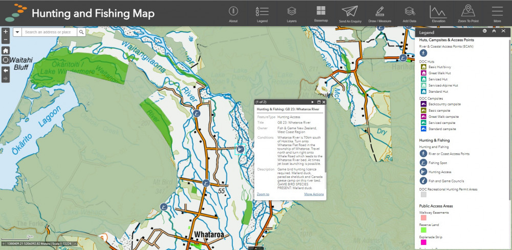
The Hunting and Fishing Map is a detailed mapping tool for hunters, anglers, and outdoor recreationists. This map combines the legal access information of Public Access Areas with hunting and fishing information. It allows people to plan trips, assess where they can hunt orfish, and understand legal boundaries. We source data in this map from Fish & Game, the Department of Conservation, and Environment Canterbury. For more information on the layers used in this map, see the data page.
Uses
- Viewing legal public access areas across Aotearoa
- Viewing Fish & Game hunting access locations, Department of Conservation huts, campsites, hunting permit areas
- Creating PDF maps including drawings and annotations
- Uploading and visualising GPS data
- Finding locations via coordinates
- Viewing satellite and aerial imagery, topographic and simplified basemaps
Tracks and Trails Map
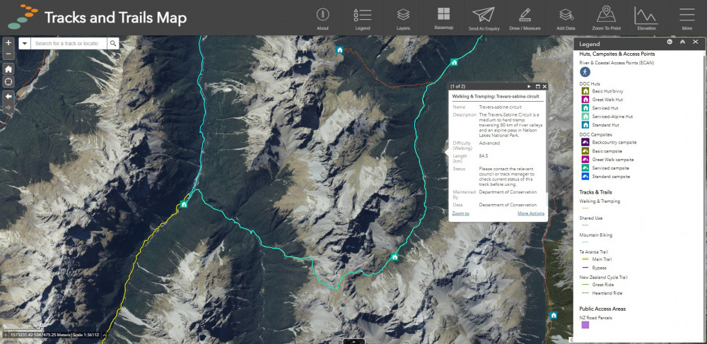
The Tracks and Trails Map shows users where local and national tracks are for a variety of different recreation activities. These include walking, tramping, mountain biking, cycling and horse riding. We source this information from Land Information New Zealand (LINZ), the Department of Conservation, NZ Cycle Trail and Te Araroa Trust. For more information on the layers used in this map, see our data page.
Uses
- Viewing legal public access areas across Aotearoa
- Finding local walking and tramping tracks, mountain biking trails, national cycling routes and Te Araroa Trail sections
- Creating PDF maps including drawings and annotations
- Uploading and visualising GPS data
- Finding locations via coordinates
- Viewing satellite and aerial imagery, topographic and simplified basemaps
Outdoor Access Map
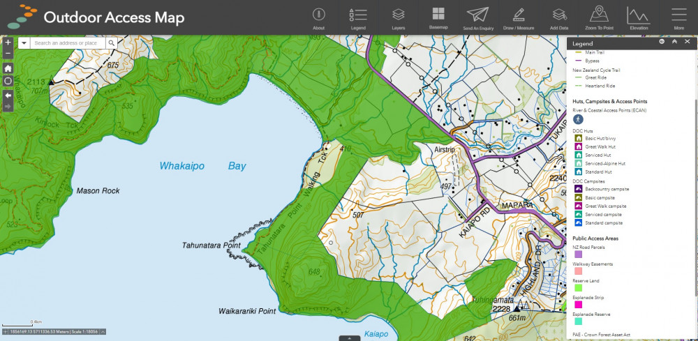
The Outdoor Access map is an all-in-one map that provides recreational, cadastral and public access information in one place. It is all the other maps combined into one. This map allows users the freedom to use all our published map data at once, without having to switch maps. because of the breadth of functionality and information in the Outdoor Access map, we recommend it to more experienced web map users. For more information on layers displayed in this map, see the data page.
Uses
- Viewing legal public access areas across Aotearoa
- Inspecting titles, parcels and legal property boundaries
- Viewing Fish and Game hunting access locations, Department of Conservation huts, campsites, hunting permit areas
- Finding local walking and tramping tracks, mountain biking trails, national cycling routes and Te Araroa Trail sections
- Creating PDF maps, including drawings and annotations
- Uploading and visualising GPS data
- Finding locations via coordinates
- Viewing satellite and aerial imagery, topographic and simplified basemaps
Or