Zoom to point
Zoom to Point allows users to find locations based on geographic coordinates and create coordinates from the map to use elsewhere. The Zoom to Point tool uses the following projected coordinate systems:
- New Zealand Transverse Mercator (NZTM) - map default
- New Zealand Map Grid (NZMG)
- WGS84 Lat-Long (Standard international coordinate system used in GPS)
- WGS84 Decimal Degrees (a simplified version of WGS84)
How to use
- Open the Zoom to Point tool from the tool menu
- Select your chosen coordinate system (NZTM for this example)
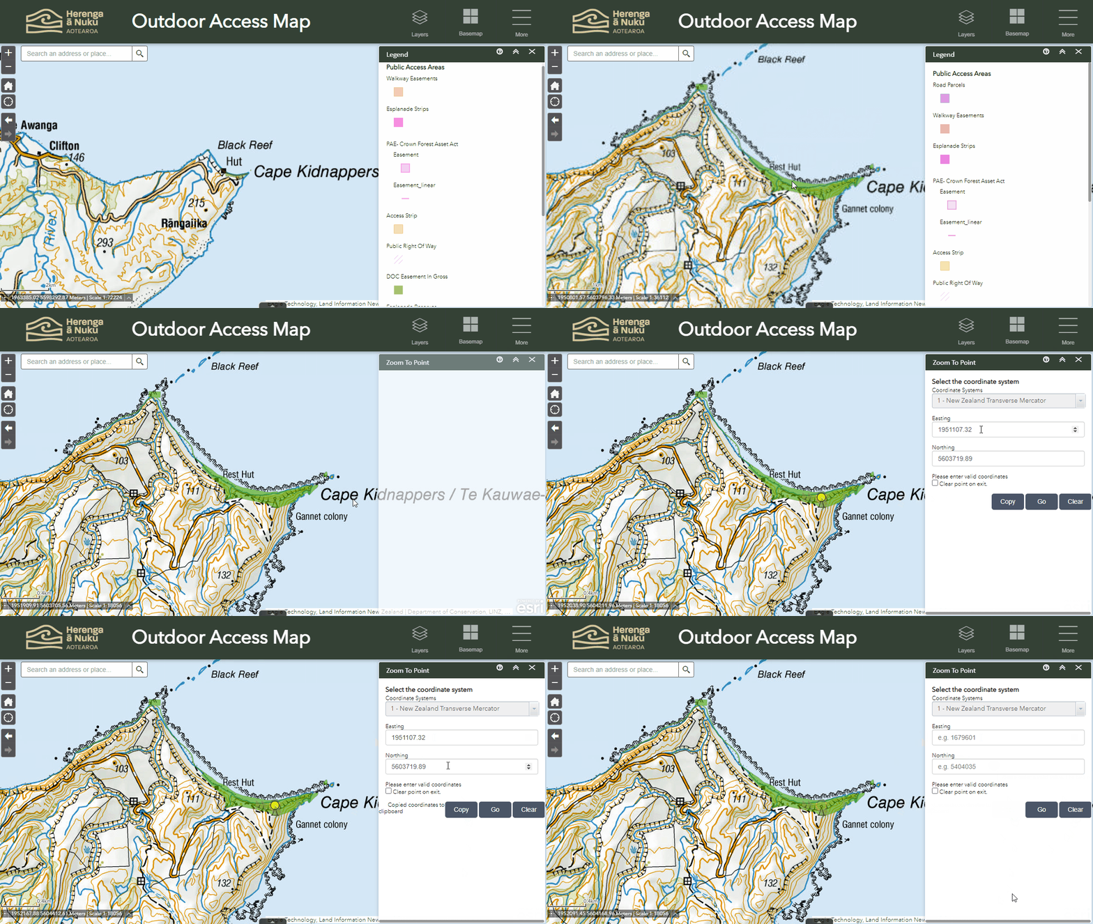
- To generate coordinates based on a map location, click on the map and a yellow circle will appear - coordinates will appear in the Easting (X) and Northing (Y) boxes.
- To copy coordinates to the clipboard, select "Copy".
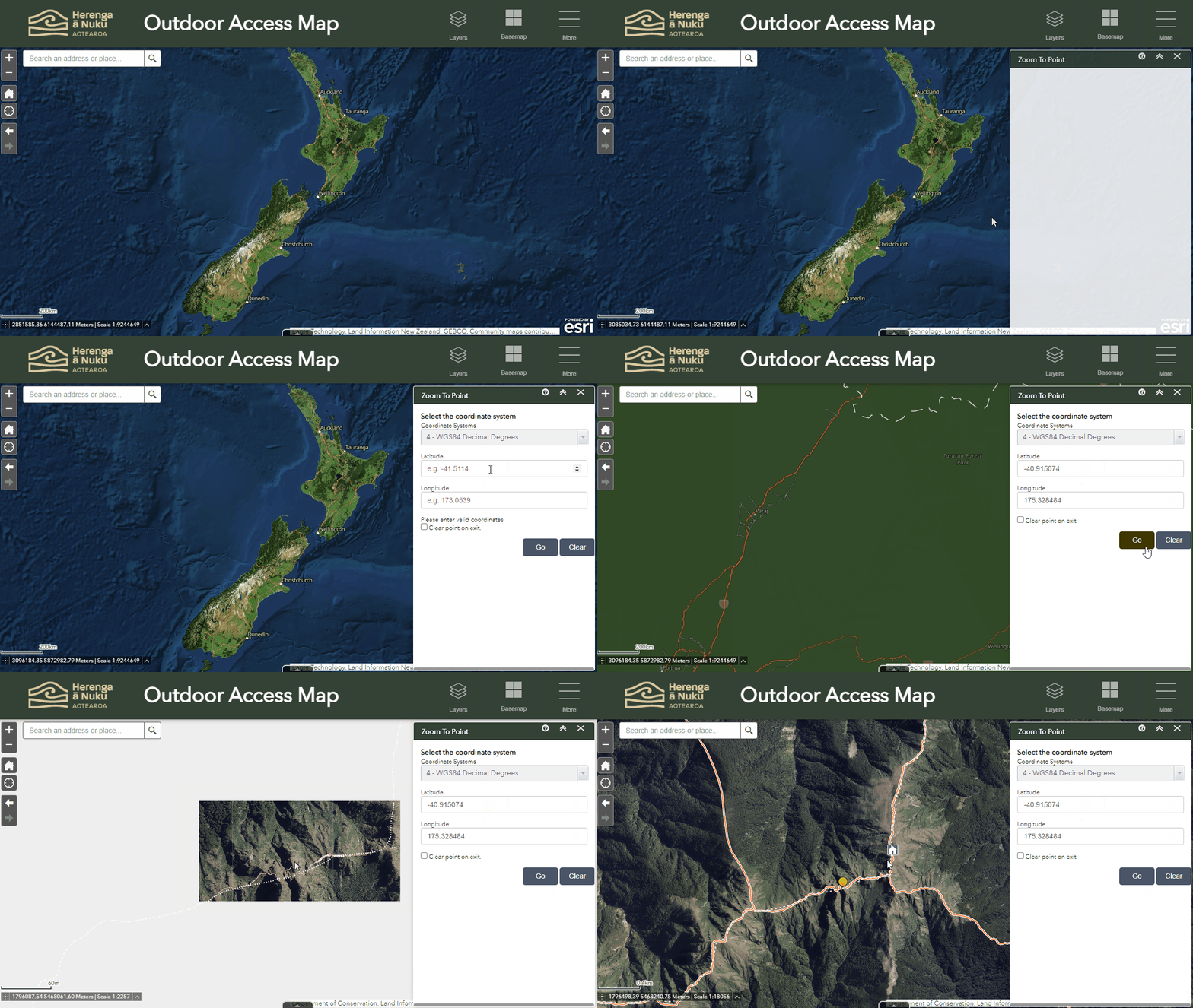
- To find a location using existing coordinates - paste the Easting and Northing (or Longitude and Latitude) into the corresponding boxes.
- Select "Go" to zoom to that location.
- To clear the coordinate boxes, select "Clear".
Demo 1: Get coordinates based on a location (NZTM Coordinates).

Demo 2: Use coordinates to find a location on the map (Decimal Degrees)


