Connecting Franklin-North Waikato Stakeholder Report
Contents
- Introduction
- Connecting communities in a time of rapid change
- The river, the sea and natural amenities
- Telling local stories to create a sense of place
- Connections to larger trails
- Summary
- Appendix – other relevant documents

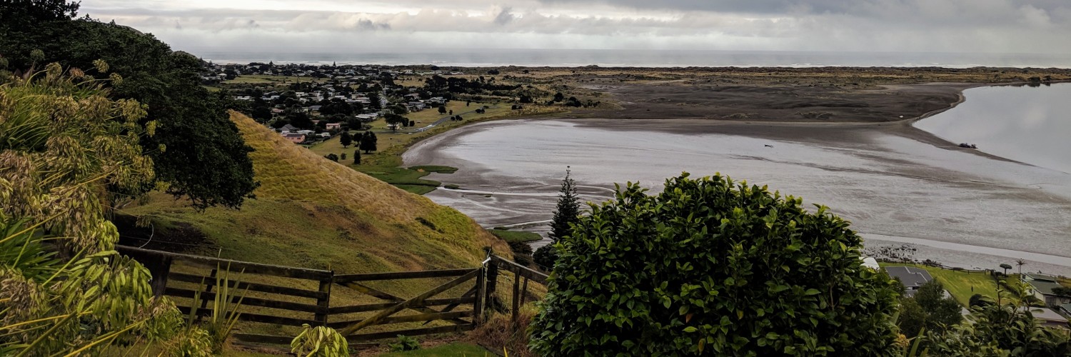
View from Mt William, by Asher Wilson-Goldman
Introduction
The Connecting Franklin – North Waikato project began in late 2018. It is a partnership between the NZ Walking Access Commission, Waikato District Council, and the Waikato Regional Council, and supported by the Franklin Local Board of Auckland Council.
A desire by local community members to highlight the need for connected communities and connection with the outdoors was at the core of this.
Community members brought the Walking Access Commission and the three councils together for a public forum in mid-2018. One of the outcomes of this was the creation of Connecting Franklin – North Waikato project.
The project fosters a shared vision and strategy for public accessways across the region. These accessways will cater for a variety of purposes, including recreation, tourism and commuting, via a variety of methods, including walking, cycling and horse-riding.
As the first stage, the Walking Access Commission conducted extensive interviews with more than 60 people who live, work and play in the area from Pukekohe in the north, to Rangiriri in the south, and between the west coast and Mangatawhiri to the east.
This report gathers together many of the issues canvassed in these interviews. It pulls out key themes and identifies opportunities to build healthy, vibrant communities in southern Auckland and the northern Waikato.
Communities in this part of Aotearoa are growing rapidly, and this growth is forecast to continue for many years to come. As farmland is subdivided for homes, and brownfields sites intensify, we need to preserve and enhance the quality of life currently present in these areas.
Connected communities are thriving communities. This project identifies opportunities to link communities in this part of New Zealand to each other, to neighbours and the natural environment.
One of the aims of this project is to, as far as possible, ignore the artificial boundary between the Auckland and Waikato regions. Residents, particularly those in towns and villages near this boundary, identified that one of their biggest challenges is dealing with three different councils with different responsibilities, planning timeframes and processes.
The Walking Access Commission helps people get to the places they want or need to go to while respecting the rights of private landholders. We are equally comfortable operating on private or public land and have existing relationships with local and central government. This allows us to work with all three councils without the constraints of legally defined geographic boundaries.
Nevertheless, we must define the scope of our project. For Connecting Franklin – North Waikato, our geographic area of focus stretches from Āwhitu Peninsula in the northeast, via Pukekohe through to Mangatawhiri and the southern tip of the Hunua Ranges in the northwest, south to Rangiriri and back west to the coast.
Project area map

However, this geographic area cannot exist in isolation, or the project will simply replicate existing boundary issues on a larger scale. Therefore, we also investigate connections north to Papakura, Manukau and the rest of Auckland, south towards Huntly and Hamilton, and east to the Firth of Thames and the Coromandel Peninsula.
Following this report, the next stage of the project will commence. We have engaged Shades of Green Ltd, led by Dr Mick Abbott, to take these themes, to look at how the landscape and geography shape communities in this area and to identify some key projects that can turn the vision into reality.
Dr Abbott has previously worked on a similar project in Taranaki (with the Walking Access Commission and Sport Taranaki) and is also engaged on a project in the fast-growing northern reaches of Auckland between Pūhoi to Pākiri (with the Walking Access Commission and Auckland Council). He has also worked with a range of others including Ngāi Tahu and the Department of Conservation.
Following the completion of Dr Abbott’s work, a governance structure will be created to oversee the implementation of the key projects. These projects will take place at a range of levels –volunteer-based community groups will do some, others may require significant central or local government funding and support.
Timeframes will differ, from the short term to the very long term.
This project will identify the possibilities so that communities and government agencies can take opportunities as they arise. Where a new subdivision is planned that could form part of a proposed connection, this project will help to ensure that all those involved – from the developers, to the council consenting staff, to residents – know what they need to do to enable connectivity. We can secure access in a piecemeal fashion as it becomes available, to ensure that, in the long-term, we can fundraise and build access infrastructure.
Thank you to the 60+ people who spoke with us for this report. We hope you see your voices and your aspirations reflected in these pages. We greatly appreciate your generosity in sharing your time, and your vision for these communities is a taonga.
Asher Wilson-Goldman
Strategic Communications and Partnerships Manager | Te Kaiwhakahaere Whakapā me te Whakawhanaungatanga Rautaki
New Zealand Walking Access Commission | Ara Hīkoi Aotearoa
Connecting communities in a time of rapid change
Population growth in this region is unprecedented. Communities are worried that, without adequate planning, they may be locked into poorly planned town centres. In the long term, they may lack connectivity. Locals have seen how expensive and difficult retrofitting urban spaces can be. They are conscious that they need to take every opportunity to plan the growth in their towns.
The dominant feeling is that growth should occur in ways that create connected, thriving communities, not disconnected dormitory suburbs. Communities commonly said they want off-road connectivity for cycling (and walking and, in some cases, horse-riding) between the various population centres, to ensure that new homes aren’t reliant on vehicular transport.
Many of the towns currently have little or no public transport. This coupled with the growing popularity of unorganised recreation (as compared to organised sport), and the increasing popularity of active transport, means the region needs processes to plan for infrastructure.
The communities want infrastructure that is suitable and safe for children to use and keeps in mind the changes in commuter demographic that e-bikes (and scooters) can create.
In some cases, existing legal access through council-owned reserves, Department of Conservation-managed marginal strips, and unformed legal roads can form significant links in chains connecting towns to each other and to local amenities.
Interviewees spoke of a concern that Waikato District Council viewed unformed legal roads as an unwanted asset to be disposed of, rather than a building block for public access and connectivity. It is critical that this view changes and that we do not lose long-term secure access in favour of short-term income for the council by selling these assets to adjoining landholders.
In other places, significant private landholdings form barriers that councils will need to resolve, via easements or other methods, to allow residents to travel to the places they want to go.
One key role of this project is identifying the connections that people need so that we can research, identify and implement appropriate routes. These points that need connecting, and actual and potential routes between them, should come together into a single digital mapping system used by councils, iwi, community groups and others, to assist with joined-up planning. The Walking Access Commission is the logical organisation to coordinate this, given our existing expertise in mapping systems and identifying legal public access.
Connection points
The population centres identified by our interviews as needing to be connected via a network of off-road trails are:
- Bombay
- Kingseat
- Mangatawhiri
- Mercer
- Meremere
- Onewhero
- Paerata
- Paerata Rise
- Patumahoe
- Pokeno
- Port Waikato
- Pukekohe
- Rangiriri
- Te Kauwhata
- Tuakau
- Waiuku
The cornerstone of the network

Tuakau Bridge, by russellstreet
Three places were discussed in our interviews more than any others. These will inevitably form the cornerstone of any future network of public accessways in the region. These are the towns of Pukekohe, Tuakau and Pokeno.
Pukekohe is 10km from Tuakau and 15km from Pokeno. Tuakau and Pokeno are 9km apart. These distances are well-suited to cycle commuting and will be increasingly so as e-bikes increase in popularity and availability.
Many of the people we interviewed had cycled these routes previously, however, the overwhelming feedback is that cycling is no longer safe on these roads, due to increasing traffic and, in particular, a rise in trucks.
Off-road options for this 3-way corridor are vital, and locals have already identified potential opportunities for these. However, most possible routes will require some access over private land. With the scale of development currently taking place, councils will likely have opportunities to require access as part of subdivision consenting processes.
In particular, properties on Ridge Rd in Pokeno, Beaver Rd in Pukekohe East, and Buckland Rd in Tuakau/Pukekohe are all potential critical links, without which trails may not be possible.
Pokeno is the logical place for routes from the west and north to meet before going south to Mercer, the Waikato River and beyond. Therefore any subdivision along potential routes south of Pokeno should be an opportunity to create partial public access south.
Council / Developer relationships
We talked to several major developers in the region, many of whom expressed similar opinions. they were willing, and in some cases enthusiastic, to provide public access in and through their subdivisions, but they required assistance from councils that often was not provided.
Developers told us that they understood how to provide access within their subdivision – through footpaths, reserves and other mechanisms. But without a clear steer from councils, they did not know how their subdivisions would connect to existing and future building developments right next door.
They wanted an overall plan of desired connectivity, so they could plan their subdivisions accordingly, and ensure a better quality of life for the people they would be selling homes to.
Developers were concerned about the vesting process for reserve land, as were council staff. We heard that offers of gifting reserves during subdivision were often refused by council planners, regardless of whether they were suitable because the council could not commit to the ongoing operational expenditure required to fund their maintenance.
According to developers, council staff were often also indecisive about whether they wanted “a square” (such as a playground or sports field) or “a ribbon” (such as a reserve, or pathways along a stream). Again, they told us better clarity from the council about the planned future for each village/town would allow them to create better outcomes.
We heard several stories of lost opportunities – of proposed green spaces, declined by council, turned instead into more houses, and the creation of cookie-cutter suburbs where everybody drives off their property by car rather than walking or cycling to the local park, shops or public transport connection.
Council funding is a very real problem. The difficulty councils have in committing to additional operational expenditure is not unique to this region. However, the lack of an overarching plan (or plans) means that decisions are often made without an adequate framework, and this means poorer outcomes for all.

Foggy morning at Pokeno, by Umedha Shanka Indranath Hettigoda
One partial solution (which won’t always be suitable) is the use of the Walking Access Commission’s Walkway Easement. Where appropriate, developers could use this to secure public access in perpetuity, with maintenance of walkways undertaken by volunteer groups of locals to lessen the financial burden on councils. Using this easement, ownership of the land would not necessarily need to be vested in council, but public access would be held in perpetuity by the Walking Access Commission on behalf of local users.
Using volunteer labour to maintain tracks and trails is increasingly common around the country, in cooperation with councils and the Department of Conservation. As people are living healthier for longer, retired and semi-retired people, in particular, have been highly enthusiastic about creating great access to build strong communities.
Councils in this region have been comparatively slow to tap into this resource. Creating appropriate mechanisms to do this will be critical if the projects identified by Connecting Franklin – North Waikato are to come to fruition.
The Walking Access Commission is well-placed to connect councils in this region with others around the country to share best practice in terms of leveraging volunteer enthusiasm, skill and time to assist with the creating and maintaining tracks and trails.
Recommendations
- Identify potential routes to create a network of largely (though not exclusively) off-road tracks and trails for walking, cycling and, where appropriate, horse riding, connecting the named population centres and natural amenities.
- Councils should identify routes for connectivity and share these with developers planning new developments, and require that these routes be protected during the subdivision process.
- Councils could also provide incentives for public access to landholders, such as rates relief for proportions of land with secured public access. Waipa District Council offers Environmental Benefit Lots in exchange for land used as part of a cycleway, including Te Awa. This could be a way to incentivise creating public access.
- Councils should develop appropriate policy and staff expertise to ensure they are making best use of volunteer effort to build, maintain and promote local walking, cycling and horse-riding tracks.
- The Walking Access Commission should facilitate creating a shared system to map potential and current public access for councils, community groups and others.
The river, the sea and natural amenities
Our interviews highlighted several natural amenities and special places that should be connected to this expanded trail network, including:
- Hunua Ranges
- Lake Waikare
- Whangamarino Wetland
- Mount William / Puketutu
- Waikato River
- Waiuku Forest
- West Coast
These places offer recreation opportunities for walking, cycling and horse-riding. While these opportunities will primarily be used by locals, there could be potential to promote some for both domestic and international tourism. In particular, the market for day trips and weekend breaks for those living in Auckland and Hamilton could be significant if the recreation opportunity is high quality.
Any access to the West Coast south of Port Waikato would be of significant benefit for recreation, and for mahinga kai for local hapū. In the longer term, a north-south cycling route from Port Waikato to Raglan offers fantastic recreational potential, and it could connect eventually from there, through Pirongia to Pureora Forest and the Timber Trail.

Kariotahi Beach, by Stefan Marks
The Mighty Waikato
The role of the Waikato River as a key connector of these communities is increasingly well-recognised. In the future, on-water journeys could be part of recreation and commuting journeys. In the short term, it is vital to see the river connecting rather than dividing people and towns and work to secure connections to and along the full length of the river.
The Waikato River has shaped this landscape and its people for many generations and created a sense of place and identity for the region. Planning for the growing towns on its banks must embrace and enhance the identity of the river and its centrality to the Waikato region.
There are two existing Great Rides south of this project area along the Waikato River. Te Awa River Ride runs from Ngaruawahia to Lake Karapiro. Approximately 20km away the Waikato River Trail begins, running alongside the river from Pokaiwhenua Bridge to Atiamuri. Some discussion has taken place on possible work to connect these two rides into a single larger ride.
Interviewees also expressed a passion for extending these cycle trails further north along the river – first to Pokeno, but eventually to the mouth of the Waikato River at Port Waikato. The opportunity to ’Ride the Mighty Waikato‘ is a fantastic chance to create a multi-day tourist attraction that could help drive money into the small communities that dot the length of the river. The route would also offer attractive outdoor recreation opportunities for locals doing short trips and day rides near their homes.
Councils should be conscious of opportunities to create access to and along the river through subdivision processes. Recreational access on stopbanks, both privately owned and those managed by the Waikato Regional Council, will also play a key role.
Waikato District Council’s work on blueprinting for the future of the river towns in its district also offers an opportunity to align both active transport and recreational corridors as these towns grow.
Wetland and lake restoration
The Whangamarino Wetland is an underutilised local recreation amenity. As a Ramsar site, it is a wetland of international importance. It is vital that any improved recreational use does not compromise the biodiversity values of the wetland, but it interviewees felt that there are opportunities to improve the use and promotion of this natural wonder.
Birdlife in the wetland is outstanding, including the world’s largest population of Australasian Bittern. The wetland is navigable by kayak with the Department of Conservation maintaining two boat ramps for access. Some interviewees suggested there may be an opportunity for boardwalked tracks through the wetland, but this would need to be investigated further.
At the southern edge of the project’s area, Lake Waikare is another opportunity for improving access, and, along with it, improving biodiversity and water quality. Currently, the lake is in poor health, but the Waikato Regional Council is working with locals, iwi and others to improve it. Volunteers helping riparian planting alongside feeder streams on nearby private farmland may contribute to a sense of community ownership of lake improvements.
The lake could offer great opportunities for walking and cycling around the outside, and kayaking through it. This will not happen overnight, but in time it could become a significant asset, in particular for Te Kauwhata and Rangiriri residents.
Mount William / Puketutu

Mt William Walkway, by Asher Wilson-Goldman
The existing Mt William Walkway offers stunning panoramic views of the entire area of this project and even further afield to the Coromandel Peninsula and the Manukau Harbour. Outside of the Hunua Ranges, it is perhaps the only peak of any considerable height. Given its proximity to Pokeno, Bombay and Tuakau it offers an excellent weekend recreational opportunity for locals.
While some of the walkway is in regenerating native bush, this could expand through community-supported replanting and pest control, to build a strong sense of community guardianship over this special place for Ngāti Tamaoho.
Currently, the walkway is only easily accessible by vehicle from the Pokeno side. Creating a safe cycle route from the town centre would also be a significant benefit.
Forest adventures
Waiuku Forest and the Hunua Ranges are the two key recreational forests in the area, offering significantly different opportunities for locals and people from other parts of Auckland.
Kauri Dieback is affecting access in the Hunua Ranges, but there are still some tracks open. Interviewees saw opening up plantation forest alongside the Hunua Ranges, currently owned and managed by Watercare, as important for recreational use. This would mitigate against lost access due to kauri dieback, but is also as genuine good recreation in its own right.
Waiuku Forest is a key place for horse riders and also dog walkers. Interviewees raised with us the increasing importance of equestrian access in the more rural parts of this region. As large farms are split into several lifestyle blocks, each block will likely have horses, but without enough land to ride them on.
Therefore, publicly accessible bridleways are more important than they used to be.
Waiuku Forest also offers potential connectivity to the north bank of the mouth of the Waikato River, which has significant recreational and cultural opportunities for locals and mana whenua.
Because of the geography in this area, significant recreational forests are less common than in other parts of the country – and people wanting these experiences are likely to go further north (to Auckland’s regional parks), south (to Pirongia and Pureora Forest Parks), or east (to Coromandel and Kaimai-Mamaku Forest Parks). It is important that residents can make the most of their local forests.
Recommendations
- Builders and designers of any local cycle routes built alongside the river take into consideration the possibility of connecting into a high quality (Great Ride grade) experience. They should consider issues like construction materials, width, and security of access.
- Councils and economic development agencies work together with existing great rides and the New Zealand Cycle Trail Trust to explore funding for a single ride the entire length of the Waikato River.
- Councils and the Department of Conservation look to build volunteer and community-driven efforts to improve water quality, pest control and replanting at the key identified sites: Lake Waikare, Whangamarino Wetland, and Mt William.
- Auckland Council and Watercare should progress efforts to reopen Watercare-owned production forest alongside the Hunua Ranges for recreational access and to develop tracks and trails for walking, cycling and horse riding on this land.
Telling local stories to create a sense of place
Time and again, across a range of people we interviewed, a desire emerged to use public access as a tool for building a sense of place for residents, and in particular those moving to the area for the first time.
Good walking and cycling access means people are more likely to navigate their towns outside of private cars and are more likely to interact with each other. This helps build a strong sense of community.
Additionally, public access infrastructure can tell stories of place in itself. For example, several people told us about a historic portage for waka near Waiuku; plans are already underway to work with local hapū on that passageway.
The area around the Waikato River is rich with stories, both Māori and Pākehā. Many of these can be told through signage and events, and also digitally, to enable new residents to learn more about the place they have chosen to call home.
In Pokeno, a museum at Queens Redoubt tells the stories of colonial troops who used that area as a staging post for the invasion of the Waikato. Other redoubts nearby form parts of potential connections on key routes in the region. These stories, honestly told, are an opportunity for all New Zealanders, Māori and Pākehā alike, to understand our shared history.
We need to be sensitive to cultures when considering how and if to tell these stories. When considering options for storytelling, first we must determine whose story it is and whether they are comfortable with it being told. There are also questions of who the most appropriate voice is to tell it.
Some of these Māori storytelling projects will be led by mana whenua iwi and hapū. Others may be partnerships between them and councils, the Department of Conservation, local trail building enthusiasts and others.
There are also Pākehā tales to tell. Waikato Regional Council holds stories of flooding and stopbanks and the human-driven changes in river flow in the years since colonisation. Through these, we can get a clear sense of the impact of farming on this land, and the impact of this land on farming. These stories, told in place on tracks and trails, can teach us all about how this region has changed over the past 150 years.

Tuakau community workshop, by Felicity Brough
Recommendations
- Iwi and hapū have conversations internally about what stories, if any, they want to share, and what support, if any, they would like to help tell them.
- Local museums and historians work with organisations building and maintaining trails to identify stories and to find appropriate ways to tell them.
- Partners consider developing a central web presence for the region, collating trails and stories under a shared roof.
- Residents’ associations may wish to produce digital or written material, or to arrange regular events, to guide new residents on a journey by foot or cycle around their area, sharing stories of history and geography.
- Councils consider public access as part of their heritage and cultural strategies.
Journeys north and south
For many people who live in the North Waikato, both now and in the future, their working lives will be further north (in Auckland) or south (in Hamilton). Connections for active transport to public transport hubs such as Papakura and likely future stops on a Hamilton-Auckland rail corridor route are crucial. Additionally, this region can form a link in longer chains of recreational access, including cycle touring and the Te Araroa trail which extends Cape Reinga to Bluff.
Public transport connections
As the population in this region grows, so will public transport networks. Already, new bus routes are beginning in some centres, and a pilot commuter train from Hamilton to Auckland is in the works.
While this train will initially have its last pre-Auckland stop at Huntly, over time we expect that there will be additional stops on the route, and one of these is likely to be in Pokeno. Therefore, route protection for commuter cycling and walking to Pokeno from the surrounding communities is critical to ensure the best use of this future rail service.
In the interim, Pukekohe will continue to be the primary entry point for commuting to Auckland. We must identify safe off-road or back-road connections to Pukekohe Train Station for commuters, in particular from Tuakau, Pokeno and Drury. Some residents have already identified potential routes which, with small amounts of investment and some securing of access over private land, could relatively easily be operational.
Connections to larger trails
Te Araroa trail is an increasingly popular jewel in New Zealand’s trail networks. Each year, the number of people walking the full length of the trail increases, both from locals and foreign tourists. Section walking is also popular in many places, where the trail provides a high-quality experience.
Sadly, much of the trail in this area leaves room for improvement. In particular, Te Araroa walkers are forced to cross a dangerous stretch of State Highway 1 between Pokeno and Mercer.
There have been changes in recent months to the trail route due to track closures caused by Kauri Dieback in the Hunua Ranges. This offers the opportunity to look at the route as it passes through this region, and there is potential for new tracks for commuting and recreation in the area to also become part of the formal Te Araroa route. Scenic options, such as Mt William Walkway and new tracks along the banks of the Waikato River, could form an attractive and high-quality section of the trail.
Unlike other parts of the country, Te Araroa in this area is not an attractive option for section walkers. A new trail from Auckland to Waikato, if planned and built well, would likely be highly used by locals on day trips as well as those walking the full length of the trail. Depending on track construction, it could also offer a cycle route in addition to walking, as some other parts of Te Araroa already do.
Similarly, there is significant potential to increase cycle touring in the area. As public transport expands south from Auckland, it will become easier for day-trippers to begin their cycle journey at Pukekohe, or one day at Pokeno, rather than Papakura. This opens up new areas of possibility including Waiuku, the hills around Onewhero, and potentially riverbank links further south towards an expanded Waikato River Trail.

Waiuku Beach, Kariotahi, by Auckland Photo News
Likewise, connecting eastwards along the base of the Hunua Ranges to the Hauraki Rail Trail is another possibility. There is already some discussion underway about this possibility. Connections further south to the existing Waikato River Trail and Te Awa, potentially to form a single trail right down to Hamilton or further south still, could offer multi-day bike-packing opportunities for domestic and international visitors.
Recommendations
- Council should identify routes for protection now to likely future rail sites, including Tuakau, Pokeno and the future Paerata Rise train stations. They should secure access as opportunities arise, such as through development consenting processes, even if building does not start for several years.
- Off-road or safe back-road cycle routes to Pukekohe Train Station should be created as a matter of priority, particularly from Tuakau, Pokeno, Bombay and Drury.
- Te Araroa should undertake a review of its current route and identify opportunities it would like help to progress that could be used by it, as well as locals. Alternatively, it may wish to just maintain a watching brief and to look in the future, once others have already created new tracks.
- Opportunities to connect Te Awa and the Waikato River Trail further north towards Pokeno should be part of any recreational trail development plans along or near the river, as they may offer attractive multi-day bike-packing opportunities to bring tourists to the area.
- Discussions between the Hauraki Rail Trail, councils and the Waikato River Trail about possibly expanding the Rail Trail to the west should consider opportunities to connect with other, non-Great Ride, routes that may be created in the area.
Summary
Connecting communities in a time of rapid change
- Identify potential routes to create a network of largely (though not exclusively) off-road tracks and trails for walking, cycling and, where appropriate, horse riding, connecting the named population centres and natural amenities.
- Councils should identify routes for connectivity and share these with developers planning new developments and require that these routes be protected during the subdivision process.
- Councils could also provide incentives for public access to landholders, such as rates relief for proportions of land with secured public access. Waipa District Council offers Environmental Benefit Lots in exchange for land used as part of a cycleway, including Te Awa. This could be a way to incentivise creating public access.
- Councils should develop appropriate policy and staff expertise to ensure they are making best use of volunteer effort to build, maintain and promote local walking, cycling and horse-riding tracks.
- The Walking Access Commission should facilitate creating a shared system to map potential and current public access for councils, community groups and others.
The river, the sea and natural amenities
- Builders and designers of any local cycle routes built alongside the river take into consideration the possibility of connecting into a high quality (Great Ride grade) experience. They should consider issues like construction materials, width, and security of access.
- Councils and economic development agencies work together with existing great rides and the New Zealand
- Cycle Trail Trust to explore funding for a single ride the entire length of the Waikato River.
- Councils and the Department of Conservation look to build volunteer and community-driven efforts to improve water quality, pest control and replanting at the key identified sites: Lake Waikare, Whangamarino Wetland, and Mt William.
- Auckland Council and Watercare should progress efforts to reopen Watercare-owned production forest alongside the Hunua Ranges for recreational access and to develop tracks and trails for walking, cycling and horse riding on this land.
Telling local stories to create a sense of place
- Iwi and hapū have conversations internally about what stories, if any, they want to share, and what support, if any, they would like to help tell them.
- Local museums and historians work with organisations building and maintaining trails to identify stories and to find appropriate ways to tell them.
- Partners consider developing a central web presence for the region, collating trails and stories under a shared roof.
- Residents’ associations may wish to produce digital or written material, or to arrange regular events, to guide new residents on a journey by foot or cycle around their area, sharing stories of history and geography.
- Councils consider public access as part of their heritage and cultural strategies.
Journeys north and south
- Council should identify routes for protection now to likely future rail sites, including Tuakau, Pokeno and the future Paerata Rise train stations. They should secure access as opportunities arise, such as through development consenting processes, even if building does not start for several years.
- Off-road or safe back-road cycle routes to Pukekohe Train Station should be created as a matter of priority, particularly from Tuakau, Pokeno, Bombay and Drury.
- Te Araroa should undertake a review of its current route and identify opportunities it would like help to progress that could be used by it, as well as locals. Alternatively, it may wish to just maintain a watching brief and to look in the future, once others have already created new tracks.
- Opportunities to connect Te Awa and the Waikato River Trail further north towards Pokeno should be part of any recreational trail development plans along or near the river, as they may offer attractive multi-day bike-packing opportunities to bring tourists to the area.
- Discussions between the Hauraki Rail Trail, councils and the Waikato River Trail about possibly expanding the Rail Trail to the west should consider opportunities to connect with other, non-Great Ride, routes that may be created in the area.

Waikato River, by Asher Wilson-Goldman
Appendix - Other relevant documents
Other agencies have developed a range of strategies, plans and other documents of relevance to this project. A partial list of these is below:
- Trails Strategy 2016: Walkways, cycleways and bridle trails by Waikato District Council
- Pukekohe – Paerata Paths Plan – an Aspirational Plan by Franklin Local Board of Auckland Council
- Walking and Cycling Strategy for the Waikato Region by Waikato Regional Council
- Vision and Strategy for the Waikato River

Waikato River Mouth, by Asher Wilson-Goldman